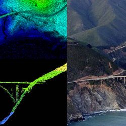
The Lidar Division was established by the ASPRS Board of Directors at its May 5 2011 meeting in Milwaukee Wisconsin. The Division is focused on all aspects of kinematic laser scanning (e.g. the entire sensing platform is in motion). The Division current comprises two committees and one working group:
Airborne LIDAR Committee: This committee develops best practices by soliciting input from the broad airborne laser scanning industry and from academia. Best practices are disseminated in both working papers and more formal specifications (such as the Vertical Accuracy Specification).
Mobile Mapping Systems Committee: This committee is a parallel committee to airborne but with the focus being land/water based kinematic laser scanning systems.
LAS Working Group: The LAS Working Group maintains and updates the LAS kinematic laser data standard.
Start your Benefits Now!
KEEP INFORMED OF INDUSTRY TRENDS, STAY CLOSE TO YOUR PROFESSION
JOIN TODAY AND START YOUR BENEFITS NOW.
THROUGH NETWORKING WITH FELLOW MEMBERS, MAKE A DIFFERENCE IN THE GEOSPATIAL COMMUNITY
Mission:
The mission of the Division is to provide a forum for collection development and dissemination of information related to the best practices in developing maintaining and operating kinematic laser scanners and associated sensors. The Division current comprises two committees and one working group:
Airborne LIDAR Committee: This committee develops best practices by soliciting input from the broad airborne laser scanning industry and from academia. Best practices are disseminated in both working papers and more formal specifications (such as the Vertical Accuracy Specification).
Mobile Mapping Systems Committee: This committee is a parallel committee to airborne but with the focus being land/water based kinematic laser scanning systems.
LAS Working Group: The LAS Working Group maintains and updates the LAS kinematic laser data standard.
Officers:
Lidar Division Director
Matt Bethel
Lidar Division Asst. Director
Nora May
Airborne Lidar Activities
Introduction
The increasing use of laser scanning technology has identified a need to establish professional practices and guidelines covering the proper planning implementation data processing and QA/QC of laser/lidar data in various mapping projects. Further adoption of ALS (Airborne Laser Scanning) and TLS (Terrestrial Laser Scanning) technologies by data users and mapping practitioners requires common data exchange formats sensor calibration routines uniform data analysis and accuracy assessments. The ASPRS decided to form our group of interest. Its first meeting was held on November 3 1999. The ASPRS LC has several initiatives underway in conjunction with sensor manufacturers data providers and data users to address these issues.
Committee Review Materials
At our annual meeting in Portland 2008 several committee members volunteered their time to generate best practice documents for review (see April 29th 2008 committee meeting minutes). So far documents relating to accuracy assessment frameworks lidar point spacing definitions and lidar sensor calibration have been submitted.
These documents are attached here for review and comment by committee members:
Quality Assurance and Quality Control of LiDAR Systems and Derived Data. Prepared by Ayman Habib & Jim Van Rens (Adobe PDF 468Kb)
A New Framework for Accuracy Assessment of Lidar Data and Derived Elevation Models. Karen Schuckman Penn State University and Lewis Graham GeoCue Corporation (Adobe PDF 2.1Mb)
Unbiased LiDAR Data Measurement (Draft) Ty Naus Fugro Horizons Inc. (Adobe PDF 680Kb)
Feel free to download and review these materials and send your feedback either to the authors directly or to the current Airborne Lidar Committee Chair.
ASPRS Board Approves LAS 1.3 Specification (08/05/2009)
The American Society for Photogrammetry and Remote Sensing (ASPRS) is pleased to announce LAS 1.3 a new release of the open file format for lidar data storage and delivery. ASPRS has been maintaining and updating this widely used specification since its inception at the beginning of this decade.
The 1.3 release adds support for waveform encoding of laser returns. The encoding of this new data extension is optional allowing LAS 1.3 to be used as the specification in normal multi-return delivery products.
“ASPRS has been very proactive in accommodating the rapid advances in LIDAR hardware technology with frequent updates to the LAS specification,” said Jim Plasker Executive Director of the ASPRS. “This latest update allows lidar system vendors to store waveform information directly in the LAS file. This new capability offers exciting opportunities for developing advanced algorithms for application areas such as urban modeling and forestry. Over 50 hardware vendors software developers production companies and commercial/government agencies participated in the development of this latest version of the specification and thus we expect that it will be rapidly adopted for both exploitation and data delivery.”
The LAS version 1.3 specification was approved by the ASPRS Board of Directors on July 14 2009 and is available for immediate use. The current version of the full specification together with superseded or suspended versions, can be downloaded from the ASPRS Standards Committee LASer (LAS) File Format Exchange Activities page.
Committee Reference Materials

