90
February 2016
PHOTOGRAMMETRIC ENGINEERING & REMOTE SENSING
SECTOR
INSIGHT:
.
com
E
ducation
and
P
rofessional
D
evelopment
in
the
G
eospatial
I
nformation
S
cience
and
T
echnology
C
ommunity
Michael Zoltek, Senior Project Manager, Woolpert
It is a challenge in the current environment of fast-paced
technological advancement to ensure those providing prod-
ucts and services are both capable and qualified to fulfill the
needs of clients and customers. How do users of current and
future technologies choose providers? How do they know that
the product or service they are receiving will have a reason-
able expectation for correctness and completeness? Licensure
and certification have provided traditional paths for demon-
strating knowledge and technical proficiency. “Certification”
has historically been utilized to evaluate and ensure technical
competence, while “licensure” has traditional-
ly been the mandate of legislation (at both the
state and federal level) premised by the need
to “
protect the public health, safety and
welfare
.” Traditional requirements to become
licensed include a combination of a defined lev-
el of formal education, experience (e.g., time),
demonstrated competency in practice (e.g.,
examples of past work), references from other
licensed persons and validation by testing.
Licensing has long been a requirement for doc-
tors, lawyers, engineers and land surveyors. As
technologies have advanced, many states have
realized the need to license photogramme-
trists, providers of a variety of geospatial infor-
mation (e.g., geographic information systems
professionals, or GISPs) and recently those op-
erating unmanned aerial systems (UAS), such
as pilots and/or flight planners. As more states
enact legislation relating to existing and new
geospatial products and services, it is difficult
for practicing professionals, state and national
organizations, and the public to keep up with
changes to existing rules and regulations and
the addition of new rules and regulations. The
American Society for Photogrammetry and Re-
mote Sensing (ASPRS), as the leading scien-
tific organization representing the photogram-
metry and remote sensing profession, provides a resource to
readily access this new and changing information through
its published maps and variety of geospatial mapping prod-
ucts and services
1
. The “Licensure Maps and Regulations”
Licensing, Certification and New Technologies
website
1
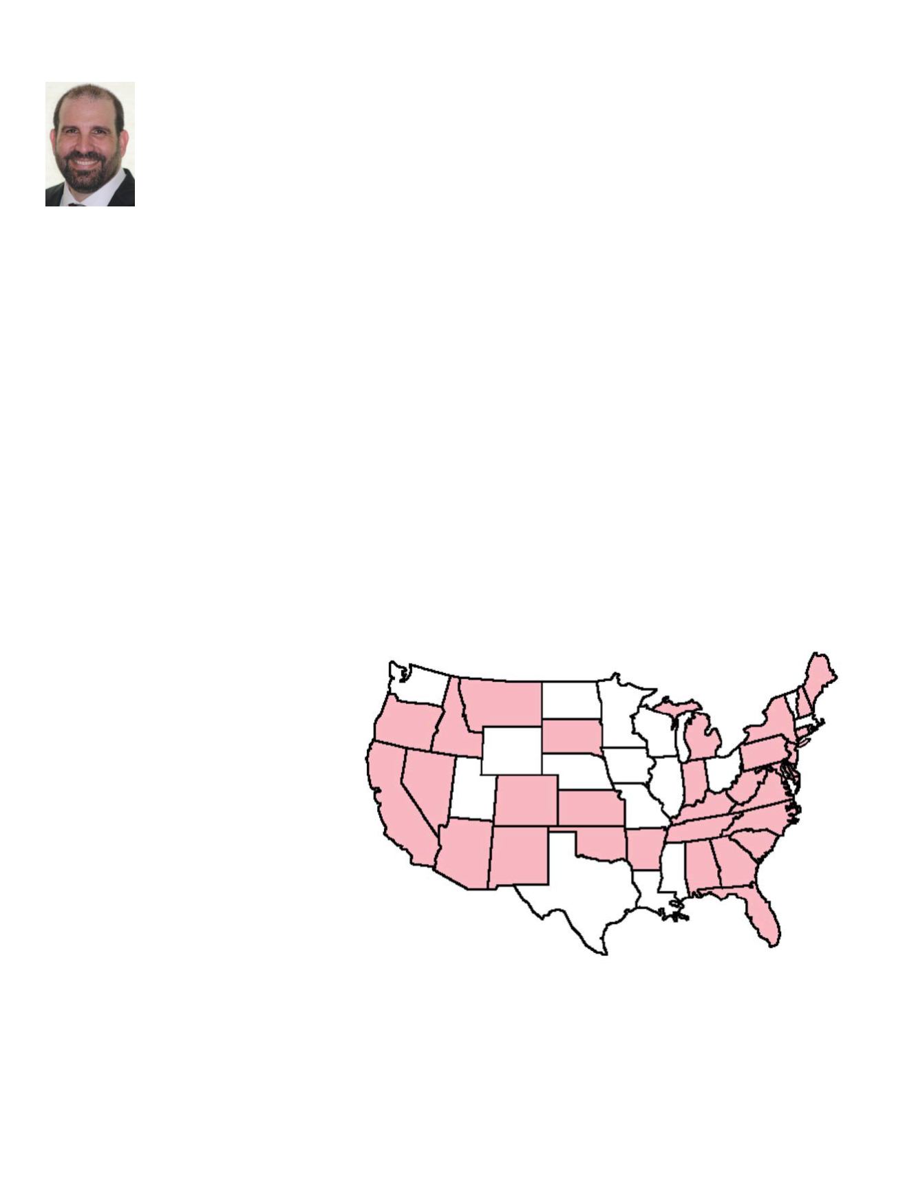
shown in Figure 1 gives meta data on State Sur-
veying Regulations; State Licensure Map for GIS Services,
Lidar and Topographic Products, Georeferenced Imagery and
Authoritative Imagery, respectively, with each state’s meta-
data on existence of State Regulations, Board Website, In-
dividual State Regulations and Composite State Regulation
Document. Currently there are twenty-one (21) states that
have existing regulations relating to georeferenced imagery
products and services, thirty-three (33) that have existing
regulations relating to authoritative imagery products and
services, forty-seven (47) states with regulations relating to
topographic mapping-related products and services, and fif-
teen (15) states with existing regulations relating to GIS-re-
lated products and services.
Figure 1: From the “Licensure Maps and Regulations” in ASPRS Profession Practice Division: The
State Licensure Map—Authoritative Imagery
State Licensure Map - Authoritative Imagery
Disclaimer: This map represents the ASPRS best effort at determining where the specific
referenced product or service (Georeferenced Imagery, Authoritative Imagery, or Topographic
Mapping) is addressed by individual state regulations relating to Surveying & Mapping. This map
is not meant to be an interpretation of said regulations. Before providing geospatial mapping
services in any State, practitioners should perform the appropriate research necessary to make a
proper determination of which licensing requirements apply to the specific type of work that will
be performed.


