common types culti-
vated along Missis-
sippi levees are John-
son and Bermuda
grass (see Figure 2).
The levee authority
periodically mows
and re-seeds the area
as part of their main-
tenance program.
For this study,
soil
EC
measurements
were collected on the
same day as radar
data in the four
AOIs
of the study area.
These measurements
were collected using
an electromagnetic
soil conductivity
meter, model EM38-
MK2, made by Geon-
ics Corporation. The
sensor in this device
reads the strength of
the electromagnetic
field which is pro-
portional to the soil’s
electrical conductiv-
ity (in units of mS/m;
millisiemens per
meter) (Morris, 2009)
over a given depth range (in this case, 0.75 m), which in turn
is related to the moisture content (Reedy, 2003). The range of
values measured in our study area was 30 to 85 mS/m. The
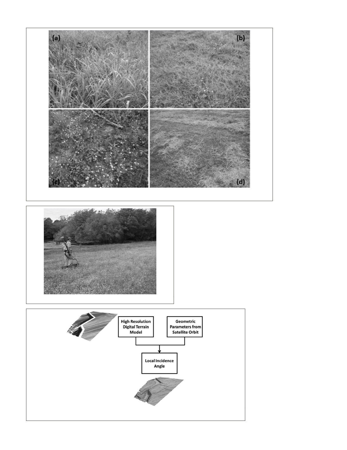
instrument was towed back and forth across a levee sec-
tion of interest (Figure 3), creating an irregular collection of
spatial samples. Samples that fell within the ground cells of
pixels (1.25 × 1.25 meters) in the radar imagery (as indicated
by concurrently acquired GPS coordinates) were assigned to
those cells.
A TanDEM-X SpotLight mode Enhanced Ellipsoid Cor-
rected (
EEC
) image with ground sample distance of 1.25 × 1.25
meters and
HH
and
VV
polarization was acquired on 26 April
2012 to support this study. The illumination direction was
from the west in ascending orbit to provide more effective
backscatter coefficients from the river side of the levee due to
impacts of the terrain.
A 0.6-meter resolution
DEM
obtained from lidar data was
used to support the calculation
of local incidence angles for the
investigation. Figure 4 shows a
demonstration of the local inci-
dence angle obtained from
DEM
and satellite geometry informa-
tion. Using the local incident
angle, we can take into account
the effects of the terrain and
levee orientation.
The conductivity over four
different vegetation areas as
shown in Figure 2 is evaluated.
Figure 2a shows
AOI
-1 which is
covered by a thick canopy (~100
percent) of green Johnson grass
with height ranging from 100 to
120 cm.
AOI
-2 shown in Figure
Figure 2. Four different areas of study for conductivity estimation: (a) AOI-1, tall Johnson grass (b) AOI-2, Ber-
muda grass (c) AOI-3, bare soil with mixed weeds, (d) AOI-4 mostly dead grasses laid over short Bermuda grass.
Figure 3. Collecting conductivity using the EM38-MK2.
Figure 4. SAR local incidence angle computed from satellite geometry and LiDAR DEM. Top-left im-
age shows the high resolution digital terrain model; Bottom image shows the local incidence angle.
PHOTOGRAMMETRIC ENGINEERING & REMOTE SENSING
July 2016
511


