accuracy. However, uncertainty remains in traditional classifica-
tion approaches when working with single date imagery, limiting
their applicability to ecological research tasks and political de-
mands. Therefore, the objective of current study was to achieve
high accuracy by efficiently classifying the bioenergy crop maize
using mono-temporal
VHR
color-infrared (
CIR
) imagery.
Study Area and Dataset
Study Area
Lucie (DE2933401) covers an area of 8,229 ha and is a part of
the district Luechow-Dannenberg in Lower Saxony, Germany
(Figure 1). It is a special protected area (
SPA
) for birds and
habitats that comes under the umbrella of Natura 2000 (Bird
Directive 2009/147/EC; Habitat Directive 92/43/EEC), i.e., an
ecologically protected area under
EU
conditions for conserva-
tion of endangered habitats, wild fauna, and flora (Europarl,
2011). Agricultural land cover included in the study area com-
prises maize, wheat, rye, barley, rape, grassland, and potato.
Dataset
Digital UltraCamXp, an airborne sensor, was used to capture
VHR
CIR
imagery in July 2010. The Digital UltraCamXp is a
product of Microsoft Corporation having an image format
of 196 megapixels (17,310 pixels across track and 11,310
pixels along track). It has a pixel pitch of 6 μm and can have
a ground sampling distance (
GSD
) of 2.9 cm at flying height of
500 m (Microsoft, 2010). The current imagery was captured
at an average flight height of 5,930 meters covering 35 cm
GSD
and having 16-bit radiometric resolution. The aerial images
had 60 percent forward overlap and 30 percent side overlap.
The imagery was radiometrically corrected for dark current
offset and vignetting effect. Camera calibration data (interior
orientation parameters), ground control points (
GCP
), global
positioning system (
GPS
), and inertial measurement unit (
IMU
)
data was provided for orthorectification.
Additionally,
ALK
(Automatisierte Liegenschaftskarte) vec-
tor data was available to aid information extraction.
ALK
is
a German cadastre map containing boundary information of
land parcels, which can serve to obtain better segmentation
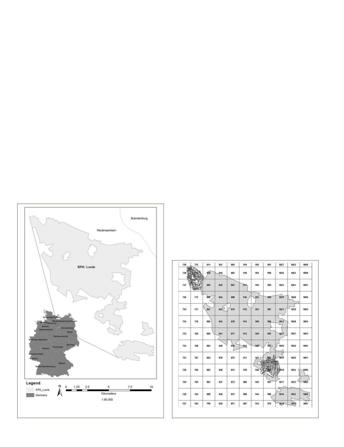
and improved classification results. A field survey of Lüchow-
Dannenberg was performed in July 2010 for collecting refer-
ence data of existed agriculture land cover. During the field
survey measurements such as land cover location, necessary
photographs, and supplementary crop parameters (e.g., height
of crop, soil cover, etc.) were taken into consideration. The
survey area was divided and labeled into ~1.5 square kilome-
ter grids (Figure 2). Reference data collected for the vicinity of
the study area partially covered grid numbers: 737, 738, 773,
774, 946, 947, 982, 983, 1018, and 1019.
Methodology
Data Preprocessing
Aerial images, camera interior orientation parameters,
GPS
and
IMU
data were integrated in
MATCH
-
AT
INPHO
software to per-
form Aerial Triangulation (
AT
). Sixty-one (61) images compris-
ing four strips were reckoned to cover the whole area of Lucie
with twenty-three (23) reasonably distributed ground control
points (
GCPs
).
GCPs
at the border of the image block were used
as control points while the rest of the points served as check-
points.
GCPs
were measured stereoscopically for utmost preci-
sion. Subsequently, a digital terrain model (
DTM
) with a 15 m
grid was produced in
INPHO’s MATCH-T
®
software using
DTM
flat
strategy.
DTM
was further edited for maximum precision.
Orthophotos were produced using the nearest-neighbor
resampling technique having 10 percent overlap and a 5
percent clip area. Final pixel size was chosen according to
the original 35 cm
GSD
. Afterwards, the orthophotos were
Figure 1. Location map of study area. Scale bar refers to ex-
panded SPA: Lucie.
Figure 2. Reference data available for the sites.
670
August 2015
PHOTOGRAMMETRIC ENGINEERING & REMOTE SENSING


