350
May 2015
PHOTOGRAMMETRIC ENGINEERING & REMOTE SENSING
R
esults
A total of 464 Landsat path/rows were analyzed across
CONUS for land cover and impervious surface change be-
tween 2006 and 2011. Image acquisition dates ranged from
05/04/2004 to 10/02/2007 for nominal 2006 imagery and from
02/05/2009 to 11/10/2011 for nominal 2011 imagery. One
additional image date was selected for circa 2011 to aid in
the 2011 classification protocol, with dates ranging from
04/17/2009 to 11/11/2011. Analyzed change products from
2006–2011 were harmonized to ensure direct change com-
parison with previous NLCD 2001 and 2006 products, and
these products (NLCD 2001 and 2006) were then re-released
as the “2011” versions.
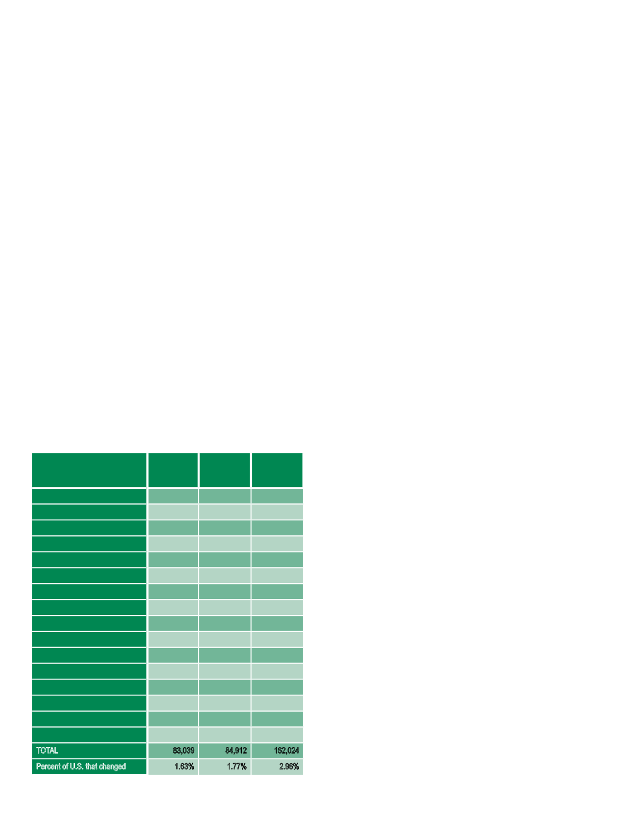
For the period 2006 to 2011, 98.23% and 1.77% of CONUS
land cover were mapped as unchanged and changed, respec-
tively (Table 2). The largest net losses occurred in the ever-
green and deciduous forest classes, covering 20,547 km
2
and
10,491 km
2
, respectively. The largest net gains occurred in
the shrub/scrub and grassland/herbaceous classes at 17,657
km
2
and 10,005 km
2
, respectively (Table 2, Figure 1).
Similar rates of no change (98.37%) and change (1.63%)
occurred during the 2001 to 2006 period (Table 2). The larg-
est net losses again occurred in the evergreen (19,905 km
2
)
and deciduous forest (5,590 km
2
) classes, and the largest net
gains occurred in the shrub/scrub 13,495 km
2
) and grass-
land/herbaceous (11,655 km
2
) classes. The overall change
rate for the cumulative period 2001 to 2011 was 2.96% (Ta-
ble 2, Figure 1).
The total land extent of urban impervious surface for CO-
NUS expanded from 6.04% of the total CONUS area in 2001
to 6.2% in 2006 and 6.34% in 2011. For the period 2001–2006,
7.62% of this impervious surface extent increased in densi-
ty (changed from a lower impervious value to a higher val-
ue), with 4.92% of the impervious extent increased in density
during 2006–2011 (Figure 2).
D
iscussion
NLCD data have remained relevant by sustaining continuous
product improvement through ongoing research and develop-
ment (Homer et al., 2004; Xian et al., 2009; Xian et al., 2010;
Jin et al., 2013; Wickham et al.. 2014) and by providing users
with products that are regionally and nationally consistent
across space and time. Products are also frequently updated
(Homer et al., 2007; Fry et al., 2011) and regularly validated
(Stehman et al., 2003; Wickham et al., 2010; Wickham et al.,
2013). The updated methods employed for NLCD 2011 pro-
duction resulted in products that include more comprehensive
land cover change detection, less commission error, and a re-
duced production time.
With the release of NLCD 2011, NLCD now provides a
decade of land cover change for CONUS over three time pe-
riods. A fundamental concept of geodesy is that Earth sur-
face measurements need to be updated routinely because the
forces that shape the Earth’s surface are constantly chang-
ing (Torge, 2001). The same is true for land cover (Wick-
ham et al., 2014), and understanding the spatiotemporal
patterns, causes, and consequences of land cover change is
now considered a scientific discipline that requires routine
measurement (Gutman et al., 2012; Turner et al., 2007). For
CONUS, NLCD has shown that 1) change was relatively
constant over the two five-year intervals that comprise the
10-year observation period; 2) there has been an non-uni-
form spatial pattern of change, with change concentrated
in the southeastern United States and localized sections of
the Pacific Northwest and Northeast (Figure 3); and 3) for-
ests have experienced the highest net losses (-66,631 km
2
)
through conversion largely to shrub/scrub and grassland/
herbaceous (+52,813 km
2
), a pattern documented in previous
decades (Sleeter et al., 2013).
NLCD 2011 impervious surface products document the
continued expansion of the urban footprint extent over the
10-year period and suggest that the rate of urban expansion
was not constant over the two five-year intervals. Urban
impervious extent increased from 6.04% of the CONUS
surface area in 2001 to 6.2% in 2006, but this nearly 0.2%
increase declined to approximately 0.1% between 2006 and
Table 2. Net land cover gains and losses by land cover class across
CONUS for the periods 2001–2006, 2006–2011, and 2001–2011 in
square kilometers (km2). Net and percentage change for each 5-year
time period do not directly add up to the 10-year net change numbers
because some land cover categories change more than once during a
10-year period. Numbers in parenthesis represent the numeric name of
the class.
2001 to 2006
Net Gain/
Loss (km²)
2006 to 2011
Net Gain/
Loss (km²)
2001 to 2011
Net Gain/
Loss (km²)
Open Water (11)
-2,268
3,941
1,673
Perennial Ice/Snow (12)
0
0
0
Developed-Open Space (21)
2,563
821
3,383
Developed-Low Intensity (22)
2,689
1,748
4,437
Developed-Medium Intensity (23)
5,441
3,609
9,049
Developed-High Intensity (24)
1,975
1,453
3,427
Barren Land (31)
2,141
567
2,708
Deciduous Forest (41)
-5,590
-10,491
-16,082
Evergreen Forest (42)
-19,905
-20,547
-40,452
Mixed Forest (43)
-4,642
-5,455
-10,097
Shrub/Scrub (52)
13,495
17,657
31,153
Grassland/Herbaceous (71)
11,655
10,005
21,660
Pasture/Hay (81)
-6,356
-3,354
-9,710
Cultivated Crops (82)
-2,312
696
-1,616
Woody Wetlands (90)
-447
-2,608
-3,054
Herbaceous Wetlands (95)
1,562
1,959
3,521
TOTAL
83,039
84,912
162,024
Percent of U.S. that changed
1.63%
1.77%
2.96%


