PHOTOGRAMMETRIC ENGINEERING & REMOTE SENSING
August 2018
479
SECTOR
INSIGHT:
.
org
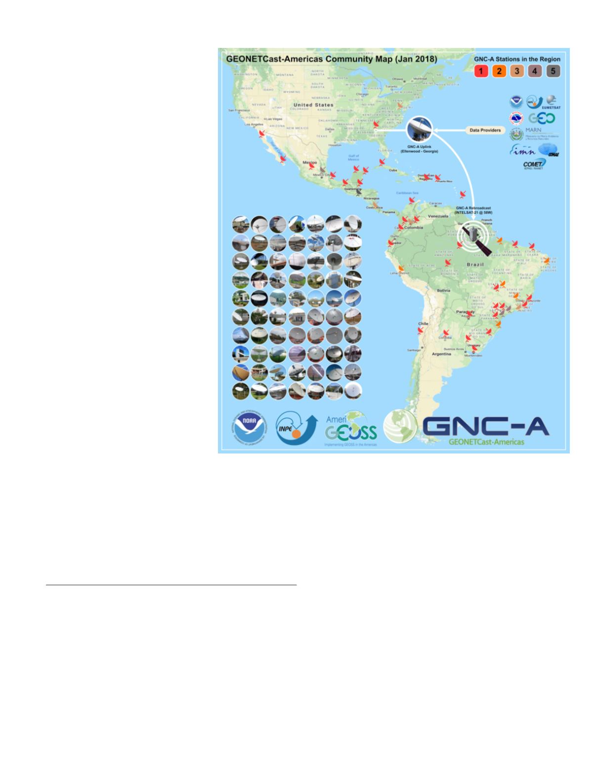
cision making process on severe envi-
ronmental events. Technology is based
on using widespread and off-the-shelf
components allowing for widespread
adoption at a cost of $5,000–10,000.
8
At the moment there are 72 stations in
the region.
A C
ommunity
P
latform
for
S
ustainability
AmeriGEOSS is working to provide
practitioners and decision makers
with sound scientific data, knowledge,
and tools to make informed decisions
for the health, welfare, and safety
of communities under conditions of
ongoing environmental change. The
AmeriGEOSS community platform
brings together social, economic and
environmental data from a global com-
munity of contributors to support com-
munal access, discovery and usabil-
ity. The platform was established to
increase regional capacity to acquire,
share, store, maintain and utilize EO
data and information. The user-driv-
en community platform is envisioned
to provide local, regional, national
and global open data accessible, tools,
applications, products and services
that support understanding and deci-
sion-making.
9
The platform provides tools and ap-
plications that support data visualization, curation, harmo-
nization, analytics, collaboration, co-creation of products and
services and other resources that can support capacity build-
ing and accelerate understanding and decision-making. It
also provides a place for the community to come together to
communicate, collaborate and participate in exploration and
application of EO data for decision-making.
1
Group on Earth Observations,
2
AmeriGEOSS,
3
/.
4
environment-latin-america-and-caribbean.
5
.
6
AmeriGEOSS Initiative,
org/amerigeoss.php.
7
GEONETCAST,
/
geonetcast.php.
8
GEONETCAST Americas,
.
com/what-is-geonetcast-americas/.
9
AmeriGEOSS,
The AmeriGEOSS collaborative framework is playing an es-
sential role in helping communities understand local to global
implications, anticipate effects, prepare for changes, and re-
duce the risk associated with decision-making in a changing
environment. ASPRS members can integrate into these efforts
through contributions on projects related to the Priority Areas.
A
uthors
Angelica Gutierrez
,
AmeriGEOSS Coordination Working
Group Chair
Ivan DeLoatch
,
GEO Programme Board Co-Chair
Nancy Searby
,
AmeriGEOSS Foundational Task Lead
Eldrich Frazier
,
AmeriGEOSS Foundational Task


