334
June 2018
PHOTOGRAMMETRIC ENGINEERING & REMOTE SENSING
Background
In Fall of 2017, GEO Jobe was awarded
a sub-contract from the engineers at Ra-
gan-Smith Associates, Inc. Ragan-Smith
is the lead on a project for a multi-state
industrial mineral production facility.
As part of their production process, the
mineral company has to pulverize and
mix various different mineral types to
produce a final product that is based on
specifications supplied by the customer.
The company is required to report the
volume of mineral stockpiles on a regular
basis, this being necessary to maintain
accurate and current data for inventory
valuation and tax reporting purposes.
Traditional methods of calculating stock-
pile volumes had been in place which
typically involved a manual field survey
capture process. However, this technique
proved to be very time consuming,
unsafe, and disruptive. Additionally to
being problematic, daily operations at
the facility were required to cease while
survey crews were on site to manually
capture fields shots from all around and
on top of stockpiles. Climbing around on
tall piles of loose gravel, stone, and sand
while managing survey poles and GPS
units is hazardous for the survey crew.
An additional problem with manual, on-
site measurement surveys of stockpiles
was that piles would be disturbed, caus-
ing material to shift, get mixed in with
other piles, or lost entirely.
Advantages of Employing
Technology to the
Problem
Employing newer methodologies and tech-
nical advances has made improvements to
the traditional measurement process. Using
a terrestrial lidar scanner, the field specialist
captures a dense 3D point cloud of millions
of observations. Post processing software
then calculates the cut/fill amounts and total
pile volume. This approach is less hazardous,
takes less time, and is less disruptive than tra-
ditional approaches. However, it still has its
limitations. When scanned from the ground,
tall piles can produce misleading measure-
ment results because the scanner interpolates
the pile’s top surface from the faces around
all sides. Imagining a volcano with a deep
crater on top, the lidar scanner will overes-
timate the volume on the pile (volcano) by
interpolating a solid fill at the top rather than
the actual hollow crater.
GEO Jobe UAV was called in to fly the
stockpiles in order to create a 3D point
cloud that completely captures the sides
and top surfaces of the piles more accu-
rately. The drone capture mission took
even less time than the ground scanner
technique, and captured a more realistic
overall surface. The more accurate surface
reproduction enables more accurate volu-
metric calculations, stockpile valuations,
and tax liability accounting. The drone
based data acquisition and photogram-
metric processing conducted by GEO
Jobe is improving standard industrial
mineral processing workflows by lowering
costs, reducing operational downtime, and
reducing workplace hazards - a significant
change to the modern work environment.
The UAV was a DJI Phantom 4Pro. The
sensor is a 1” 20 Megapixel CMOS sensor.
Processing software was Pix4D Mapper.
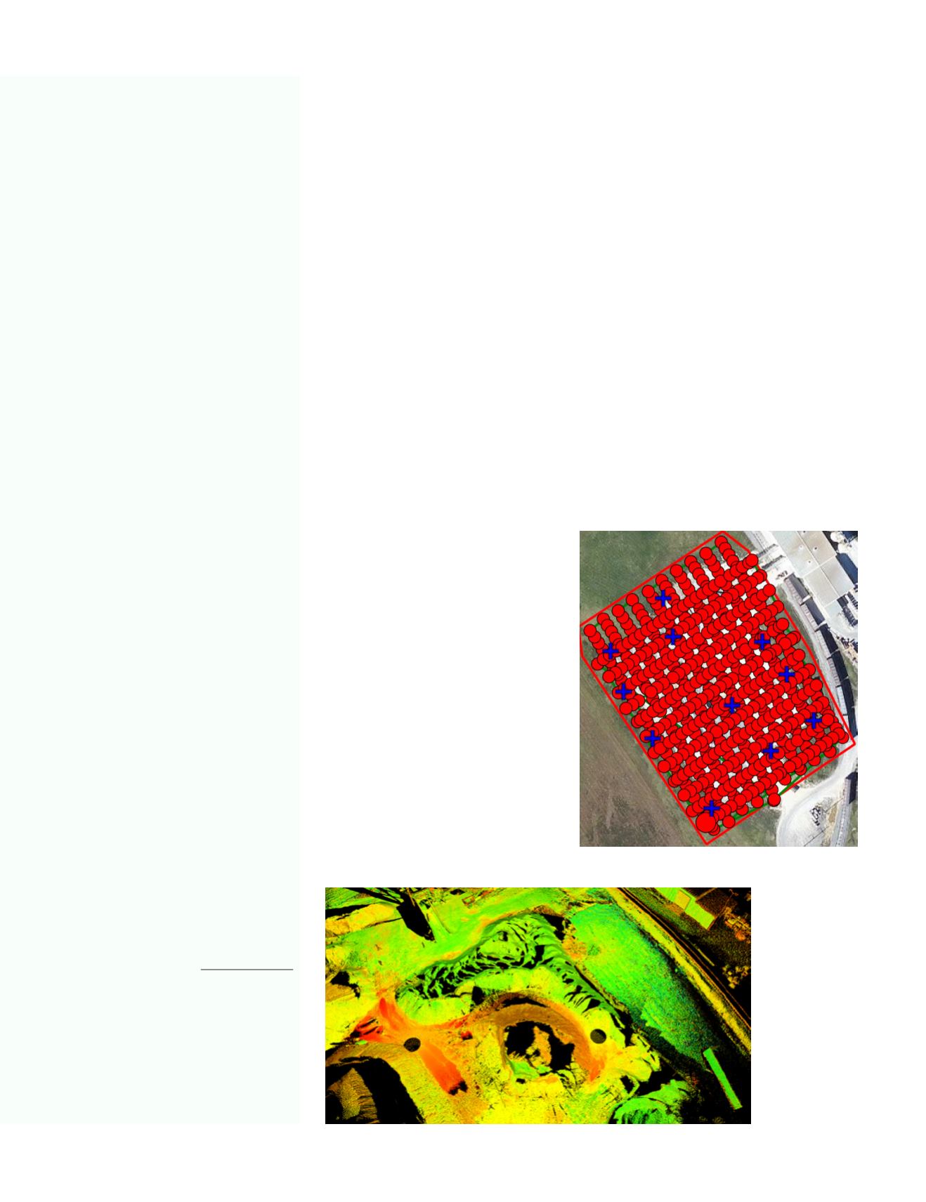
The flights were flown with 85% frontal
and 80% side overlap, at 150’. A total of 600
photos were taken to cover the 6-7 acre area
of interest. Extended flight distance was
slightly over 2 miles. The Photogrammetric
approach GSD was .46” (1.17cm). The RMS
error was .046’ (.552”, 1.04cm). We used the
same benchmarks that previous scans used
thus the GPS collection time is very similar
under both approaches. Total flight time was
27 minutes. It took approximately that much
time just to set up the lidar Scanning equip-
ment, in the initial of several locations. Scan
time was longer.
Point cloud from
terrestrial lidar.
Mission flight plan and ground control points.
Photogrammetric Engineering &
Remote Sensing
Vol. 84, No.6, June 2018, pp. 333–335.
0099-1112/18/333-335
© 2018 American Society for
Photogrammetry and Remote Sensing
doi: 10.14358/PERS.84.6.333


