PHOTOGRAMMETRIC ENGINEERING & REMOTE SENSING
November 2018
675
by
Clifford J. Mugnier, CP, CMS, FASPRS
T
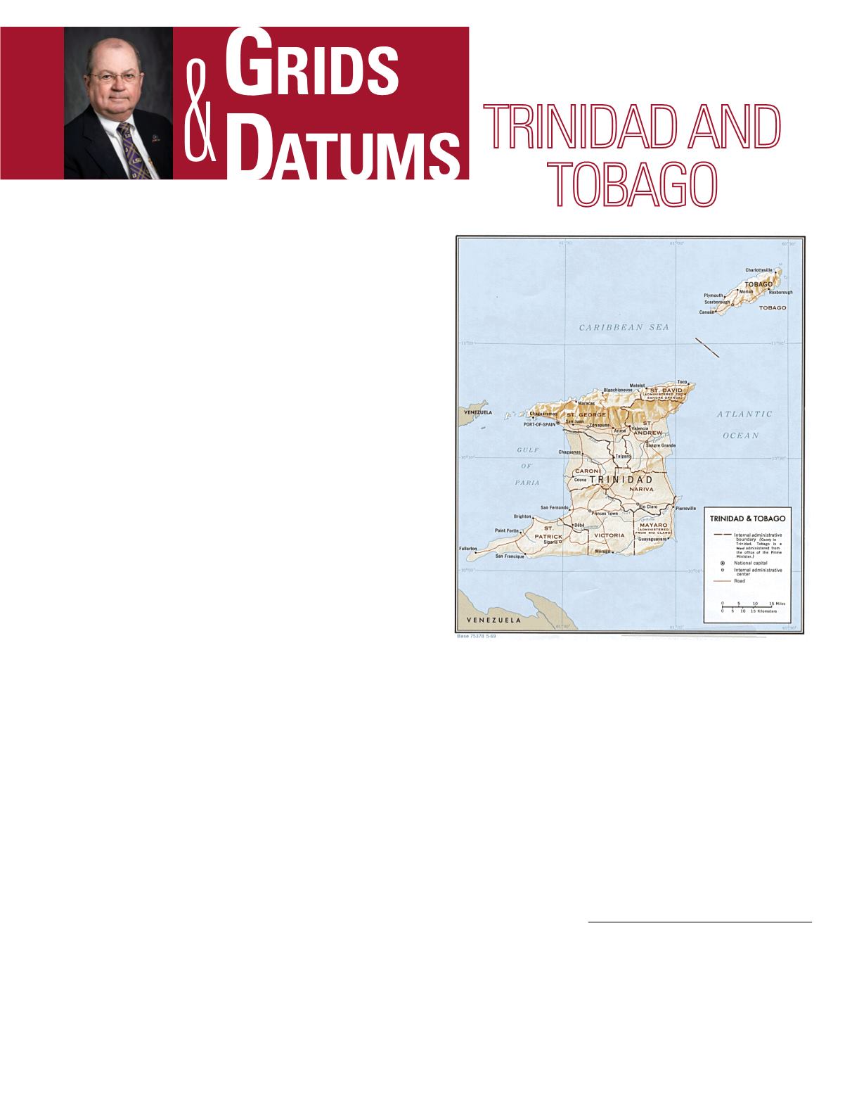
rinidad and Tobago was originally popu-
lated by the Igneri, a relatively peaceful
Arawak subgroup, and by the cannibal
Caraïbes. Trinidad was discovered by Columbus
in 1498, the Spaniards established a colony on the
island in 1577, but Sir Walter Raleigh destroyed it
in 1595. Occupied by the British in 1797, Trinidad
was formally established as a colony in 1899 and
was a member of the West Indies Federation from
1958-1962.
Tobago, in contrast, was not colonized by Spain; it has
had a most varied history, and experienced a remarkable 31
changes of possession before finally being recaptured by the
British in 1803. The first oil deposits on the island were dis-
covered in 1866, by 1908 crude oil production began, and in
1912 the first oil refinery was established. The first interna-
tional boundary treaty between two sovereign nations that
divided the mineral resources of the ocean bottom was signed
by Venezuela and the United Kingdom in 1942. Both Trin-
idad and Tobago, and Venezuela are parties to the Geneva
Convention on the Continental Shelf. In 1954, marine drill-
ing began off the West coast of the island in the Gulf of Paria.
The Republic of Trinidad and Tobago became an indepen-
dent state in 1962. In 1968, petroleum discoveries off the
East coast propelled Trinidad to the enviable status of the
wealthiest nation in the Caribbean. The highest point in the
Republic is El Cerro del Aripo, at 940 m (3084 ft.). The is-
land of Trinidad is mostly low plains with some hills and low
mountains in the north; while the island of Tobago is also low
in the southern part and hilly to its north. My children and
I found the shallow coral reefs to the south of Tobago to be
spectacular!
In 1787, the Spanish Governor of Trinidad signed the first
Instructions for Surveyors. The last sentence reads: “All
which shall be faithfully and punctually observed, as has
been provided in these instructions, of which an attested
copy, under my hand, is to be given to every surveyor, mak-
THE REPUBLIC OF
The Grids & Datums column has completed an exploration of
every country on the Earth. For those who did not get to enjoy
this world tour the first time,
PE&RS
is reprinting prior articles
from the column. This month’s article on The Republic of Trinidad
and Tobago was originally printed in 2000 but contains updates
to their coordinate system since then.
ing him sign at the bottom of this original a receipt,
in order
to convict him as necessary
(
emphasis added
).” (
Signed
)
P
edro
de
I
barrarte
.
The first triangulation of Trinidad was carried out from
1900 to 1903 by E.R. Smart, M.A., with third-order extensions
carried out until discontinued in 1911. The Orange Grove
Base Line was first laid out and then measured three times
with a Gurley 300 ft. steel tape. The tape was certified at the
U.S. National Bureau of Standards. The mean distance was
8,085.034 ft. (~2,464 m). The triangulation was then carried
westwards to Battery, Port of Spain, the Longitude of which
had been accurately determined by telegraph by LCDR.
Green, U.S.N., in 1883 at Orange Grove Meridian where
f
Photogrammetric Engineering & Remote Sensing
Vol. 84, No. 11, November 2018, pp. 675–677.
0099-1112/18/675–677
© 2018 American Society for Photogrammetry
and Remote Sensing
doi: 10.14358/PERS.84.11.677


