PHOTOGRAMMETRIC ENGINEERING & REMOTE SENSING
April 2015
261
B
enefits of
U
sing a
UAS
While UAS are currently being used
for numerous environmental mapping
applications, to our knowledge this
project represents the first time a
UAS has been used for mapping ASM.
One of the principle benefits of using
a UAS for this application is that very
high-resolution data can be collected
over a relatively large area in a short
amount of time. In this study, the UAS
collected data at an approximate rate
of 1.5 km² (150 hectares) per hour.
Small UAS have low operational
flying altitudes (typically 50-300 m)
and therefore the resolution of the
data significantly enhances visual
image analysis (Galvez et al., 2014)
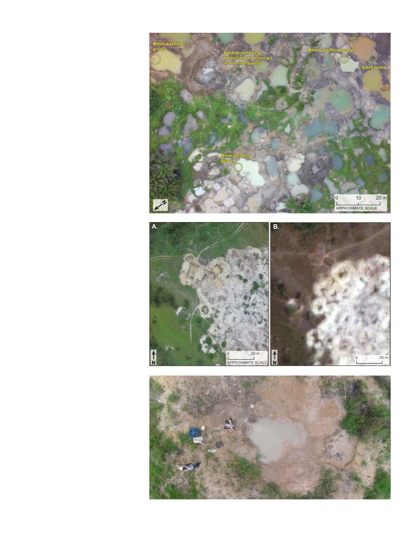
(Figure 4). The resolution of the data
collected in Guinea allowed us to
clearly distinguish active pits from
inactive pits, locate and measure piles
of extracted gravel and sedimentary
layers, and detect changes in water
color and sediment properties
(Figures 5 and 6). The ability to map
an entire site from one or two field
locations is particularly beneficial
for ASM research, as mine sites are
often located in remote areas, can be
several square kilometers in size, and
sections of sites may be inaccessible
or even dangerous for researchers
to traverse due to a lack of roads,
surficial disturbance due to mining,
or other challenging terrain. Utilizing
a UAS, the field team was able to
acquire complete aerial coverage of a
site in under an hour.
Figure 4. An example of UAS imagery collected
at 100 m altitude over the Khoboto site in the
Forecariah Prefecture study area in western
Guinea.
Figure 5. Comparison of the spatial resolution of
the UAS imagery (A) collected at the Banyama
site in the Forecariah Prefecture in western
Guinea with a pan-sharpened high-resolution
(0.5 m) multispectral satellite image (B) of the
same site.
Figure 6. A low altitude photo of miners working
at a pit in the Forecariah Prefecture study area in
western Guinea collected using the UAS.
(4)
(5)
(6)


