PHOTOGRAMMETRIC ENGINEERING & REMOTE SENSING
January 2015
7
U
sing
G
eospatial
T
echnologies
The following sections are organized by
geospatial technology and include within
each section both the methods and results.
P
aper
R
ecords
to
GIS
All existing cemetery maps and burial
records were on paper. We used both sets of
information to create a GIS database.
We first created a polygon feature layer of
the individual lots in the Old section of the
cemetery from the 8 ½” x 11” map in Marshall
(2009), which was the only hard copy of this
map available to us. This map was a composite
of traditional land survey maps produced
in 1894, 1906, and 1909. The maps lacked
references to a geographic coordinate system,
and to any features outside of the cemetery
boundaries that could be used to place the map
within a geographic coordinate system. This is
simply a reflection of the era that produced
the maps rather than any sort of inherent
deficiencies in relative spatial locations.
Placing the maps within a geographic
coordinate system requires relating the local
coordinates of at least four points on the map
to the locations of the same points in a known
geographic coordinate system. These points
should be well-distributed, since rectification
accuracy decreases outside of the spatial
bounds of the ground control points (Welch
and Jordan, 1996; McGlone, 2013). The known
coordinates can come from ground collected
GPS points or from newer orthorectified
imagery of adequate spatial resolution and
positional accuracy. We first attempted
rectification using freely distributed 2009
National Agriculture ImageryProgram(NAIP)
true-color, growing season (leaf-on) imagery
with 1-m spatial resolution. However, the
spatial distribution of coincident identifiable
features between the paper map and the NAIP
imagery was limiting. The map of lots lacked
accurate geographic references outside of the
lot boundaries. In the NAIP imagery, the
extensive tree canopy obscured many ground
features. We then used a Trimble Geo6000 Xh
GPS to collect ground control points within
OHC, with a post-processed accuracy of ±1
to 2 m. The resultant root mean square error
(RMSE) after georeferencing was ±3.6 m and
this is the error associated with the spatial
location accuracy of our GIS feature layer.
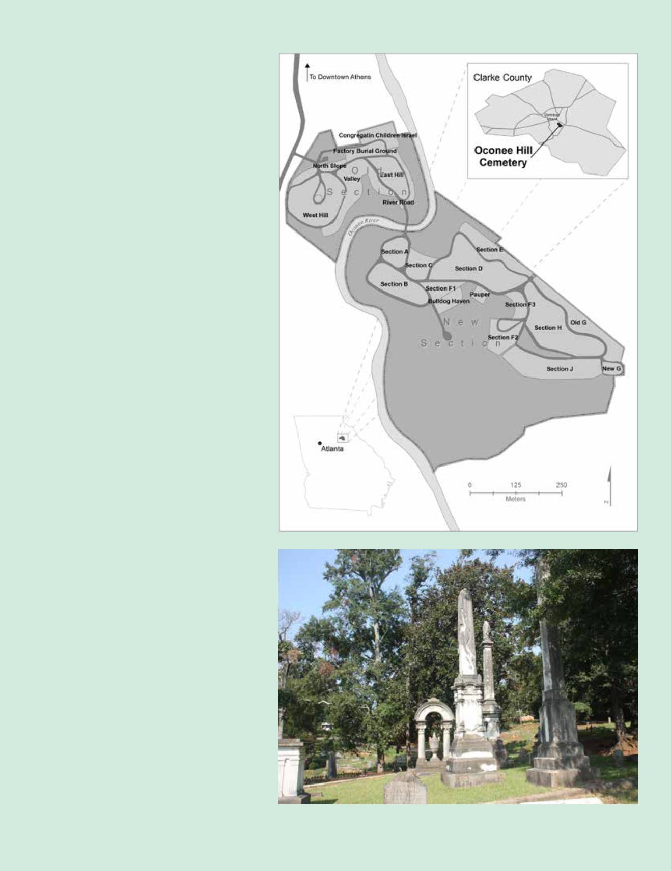
Figure 1. Location of Oconee Hill Cemetery in Athens, Georgia, USA.
Figure 2. Example of the monuments in the Old section of Oconee Hill Cemetery.


