equivalent (
NSIDC
, 2014b).
GLA14
elevation points are avail-
able globally from 86°N to 86°S latitude with a sub-metric
precision that is a function of the terrain slope (Brenner
et
al.
, 2007). Guidelines for Digital Elevation Data produced
from the National Digital Elevation Program (
NDEP
) mention
that: “the independent source of higher accuracy should be at
least three times more accurate than the dataset being tested”
(
NDEP
, 2004). Therefore, with a sub-metric accuracy,
GLA14
data were considered suitable for the evaluation of the
CDED
(5 to 10 m accuracy). All available points from version 33 of
GLA14
within the
AOI
were used (72,860 points) for this study.
Sources of Inaccuracy in GLA14 Data
GLA14
elevation points could be affected by an attitude miscal-
culation, a saturated return, equipment noise, the atmosphere,
or by variable elevation within the footprint. These sources of
inaccuracy are discussed in this section.
Knowledge of the laser’s attitude represents the most
common source of error in
GLA14
elevation values (Brenner
et
al.
, 2007). The computed
GLAS
attitude is strongly influenced
by small uncertainties in the nominal angular orientation of
the
GLAS
optical bench. The pointing direction is determined
onboard the satellite using stars as fixed reference points.
The accuracy of the attitude directly impacts the accuracy
of the geolocation of the elevation points (Bae
et al.
, 2002),
particularly over steep areas, where small horizontal shifts may
induce large changes in the elevation value (Martin
et al.
, 2005).
Saturation occurs when the receiver is overloaded by
the return-pulse. It introduces a delay in the recorded
displacement time, which translates into an underestimation
of the apparent elevation varying from centimeters to meters
(Carabajal
et al.
, 2006). To prevent signal saturation, and
to amplify lower energy echoes, the gain is automatically
adjusted according to the pulse amplitude of previous laser
shots. However, this strategy may result in saturation when
rapid changes in surface reflectivity occur (Zwally
et al.
, 2008).
Equipment noise is another source of error, especially
for weak laser intensity (Fricker
et al.
, 2005). Indeed, as the
power of the laser decreases with time, the noise, amplified
by the gain, could influence the measurements.
The laser signal might be impacted by the atmospheric
transmission at the laser’s wavelength. Scattering by thick
clouds and fog can attenuate as well as redirect and delay a
substantial fraction of the return pulse. This can generate
GLA14
outliers where, in the most extreme conditions, the elevation
corresponds to optically thick clouds located at all altitudes in
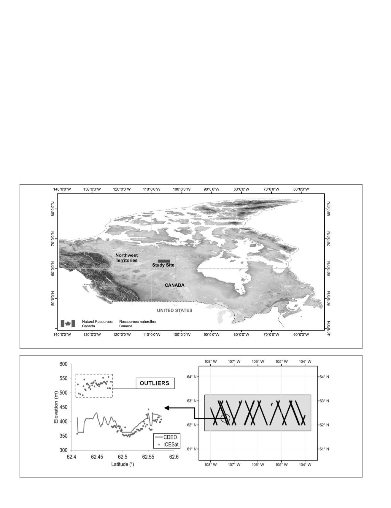
Figure 1. The location of the study site.
Figure 2. Outliers illustrated with respect to the CDED elevation for a section of an orbit line over the AOI.
702
September 2015
PHOTOGRAMMETRIC ENGINEERING & REMOTE SENSING


