PHOTOGRAMMETRIC ENGINEERING & REMOTE SENSING
April 2016
253
T
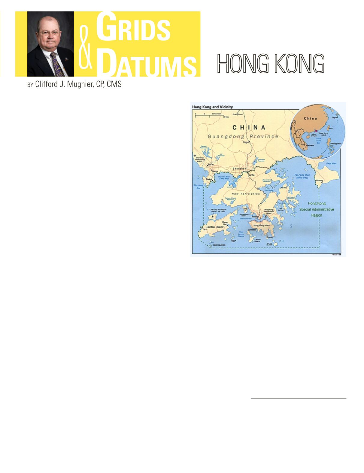
his month’s topic features Asia and,
specifically, the former British Crown Colony
of Hong Kong. The British occupied the
Island in 1839. The Treaty of Nanking was signed in
1842 which ceded Hong Kong to Great Britain. The
Convention of 1860 added Stonecutter’s Island and
in 1898, the New Territories were leased to Great
Britain. The 99-year lease expired on July 1, 1997,
andHong Kong was restored to the People’s Republic
of China as a separate administrative region.
Triangulation stations first appeared on a map of Hong Kong
produced in 1845 by Lt. Collinson of the Royal Engineers.
Additional maps were produced in 1899/1900 and 1903/1904
with triangulation stations shown, but survey records no
longer exist for those triangulations. The 2nd Colonial Survey
Section of the Royal Engineers (Survey of India) did basic
triangulation in 1924; others adjusted the observations in
1928-30, and again in 1946. This was adopted collectively as
the main triangulation of Hong Kong.
Early planimetric plane table mapping was at 1:600 scale
in Hong Kong and Kowloon. The Hong Kong New Territories
Datum of 1924 (HKNT24) is defined on the Clarke 1880
ellipsoid where a = 6378249.145 meters,
1
/
f
= 293.4650, and 1
meter = 3.280869330 Hong Kong feet. Trig “Zero” was 38.4 feet
due south of the transit circle of the Kowloon Royal Observatory
on Victoria Peak such that the datum origin was: Φ
o
= 22° 18´
12.82˝ N, Λ
o
= 114° 10´ 18.75˝ E, and azimuth from “Tai Mo
Shan” (Trig 67.2) to “Au Tau” (Trig 94) = 292° 59´ 46.5˝. The
Cassini-Soldner Grid system was used with its origin the same
as the HKNT24 datum and with coordinates of 5.18 Ft. North
and 0.38 Ft. East. Such strange-looking coordinates for a Grid
origin are common for the 19th and early 20th centuries, and
large areas of Hong Kong actually had negative coordinates.
In 1963, a re-triangulation was carried out because the
HKNT24 network could not meet the accuracy requirements
for large-scale mapping and cadastral surveys. The Hong Kong
Datum of 1963 (HK63) was defined on the
older
Clarke 1858
ellipsoid where a = 6378235.6 meters, and
1
/
f
= 294.2606768.
HK63 Datum, again with its origin at Victoria Peak, was used
to develop a new Cassini- Soldner Grid with the false origin
southwest of Lantau Island so that the coordinates in the
Hong Kong New Territories were all positive values. The False
Easting was 120,000 Ft. and the False Northing was 50,000
Ft. Subsequent mapping was performed at 1:1,200 scale. As
mentioned previously in this column, the Cassini-Soldner is
one of the old (but popular) aphylactic projections. The reader
will recall that an aphylactic projection is not conformal, it is
not equal-area, and it is not azimuthal. It was easy to construct
with very simple tools and with modest projection tables, and
it was popular for British colonial and “expedition” mapping.
In 1963, the standard computational tool of the geodetic
surveyor (and photogrammetrist) was an electric-powered
mechanical calculator which was equipped with the very fancy
square-root keys (the cost was 4 - 6months pay). A rotary “pepper
mill” Curta calculator (made in Liechtenstein and costing 2 - 3
weeks pay) would do just fine in a tent. (Note that the IBM 1620
The Grids & Datums column has completed an exploration of
every country on the Earth. For those who did not get to enjoy this
world tour the first time,
PE&RS
is reprinting prior articles from
the column. This month’s article was originally printed in 1998.
Photogrammetric Engineering & Remote Sensing
Vol. 82, No. 4, April 2016, pp. 253–254.
0099-1112/16/253–254
© 2016 American Society for Photogrammetry
and Remote Sensing
doi: 10.14358/PERS.82.4.253


