Table 5 compares the results of the proposed methodol-
ogy with that of
MST
for the three tested images. Furthermore,
Since the
MST
is a single-linkage tree structure, closed loops
are not possible. In comparison with the proposed methodol-
ogy, this limitation arises as more missed road segments in the
MST
results which reduce the completeness value. In addition,
in contrast to the proposed methodology,
MST
is not effective
in the vectorization of very close parallel roads which are
depicted in enlarged portions of Figures 12 and 13 (c and d).
Evidently, a close comparison indicates that our methodology
is able to extract a larger accurate road network than the
MST
.
In all of the experiments, missed road segments are partly
caused by context objects like rows of trees, buildings, or their
shadows were found at places along the roads in the image
(see Figure 11). As a result of road detection failure in this situ-
ation, the distance between two road key points becomes too
large to be bridged during the road key point connection stage.
Incorrectly extracted road segments particularly occurred
at three or four-leg junctions where some nearby road key
points existed. Therefore, an enclosed area is created in the
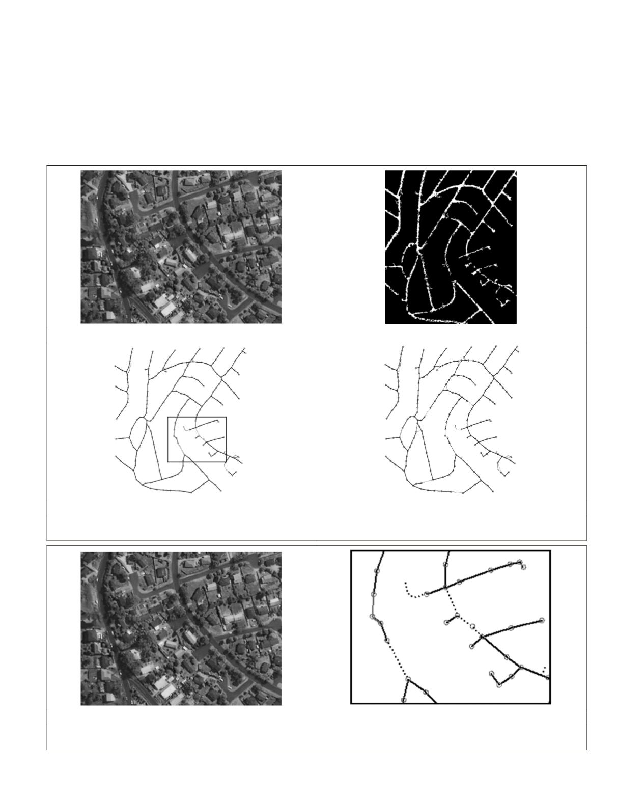
(a)
(b)
(c)
(d)
Figure 10. Results of urban Hobart: (a) original image, (b) detected road image, (c) results of the proposed methodology, (d) results of MST.
Correctly extracted roads are given in dark solid lines, incorrectly extracted roads in light solid lines, and missing roads in dotted lines.
(a)
(b)
Figure 11. (a) Enlarged cut-out from the original image in Figure 10a, and (b) result of the proposed methodology for the same cut-out in
Figure 10c.
PHOTOGRAMMETRIC ENGINEERING & REMOTE SENSING
February 2016
115


