318
May 2016
PHOTOGRAMMETRIC ENGINEERING & REMOTE SENSING
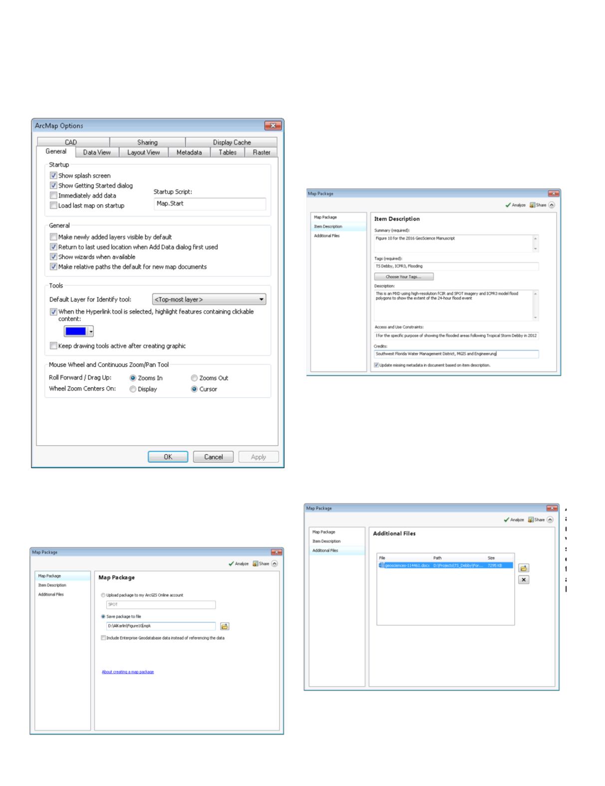
EXTRA TRICK:
You can make relative pathnames the default
by going to Customize | ArcMap Options; on the General
Tab, check the “Make relative paths the default for new map
documents” checkbox. A good practice is to check (File | Map
Document Properties) and add metadata to your MXD.
STEP 2 — START THE MAP PACKAGE DIALOG
In ArcMap, use the File | Share As | Map Package option;
this will start the dialog boxes. There are several options
of where to publish your map package. For my purposes, I
instruct students/users to choose the “Save package to file”
option and use the folder icon to direct the output to a specific
folder and filename of your choice.
STEP 3 – ENTER THE ITEM DESCRIPTIONS (REQUIRED)
Enter all required fields for the Item Descriptions. Note that
checkbox on the bottom of the dialog will use the information
that you input here to populate the MDX’s metadata (if you
did not input those data previously.)
STEP 4 – ADD ADDITIONAL FILES INTO THE MAP
PACKAGE (OPTIONAL)
At this point, you can add other files to your map package. If
you want to add Excel spreadsheets, or Word documents, this
is the time. (In the example, I added a Word file to the Map
Package.)


