530
August 2017
PHOTOGRAMMETRIC ENGINEERING & REMOTE SENSING
Data Dissemination
Image Services
Until 5-7 years ago, dissemination of emergency response
data primarily relied on “tennis shoe” delivery of hard drives
to the users. However, the proliferation of high bandwidth in-
ternet connectivity and standards for web hosting of geospa-
tial data has made this step considerably quicker and easier:
•
As soon as data is ready, it is hosted out as an imagery
service under REST (Representational State Trans-
fer) protocols that make it accessible by virtually any
off-the-shelf GIS system as well as Java viewing for
desktops, PCs, smart phones, smart tablets, etc.
•
For users requiring “hard pixels,” projects the size of
the Meramec River response can be delivered using FTP
protocol.
•
For larger response efforts, the hard drives are hand-
delivered or shipped by commercial carrier/courier.
By adhering to protocols such as WMS (Web Map Service)
and OGC (Open GIS Consortium) for image services, a num-
ber of exploitation uses are accommodated for users with
varying levels of geospatial awareness and tools:
•
A simple Java viewer provides a product to the general
public.
•
Within a GIS software suite, such as Esri’s ArcMAP and
ArcGIS.
•
Google Earth.
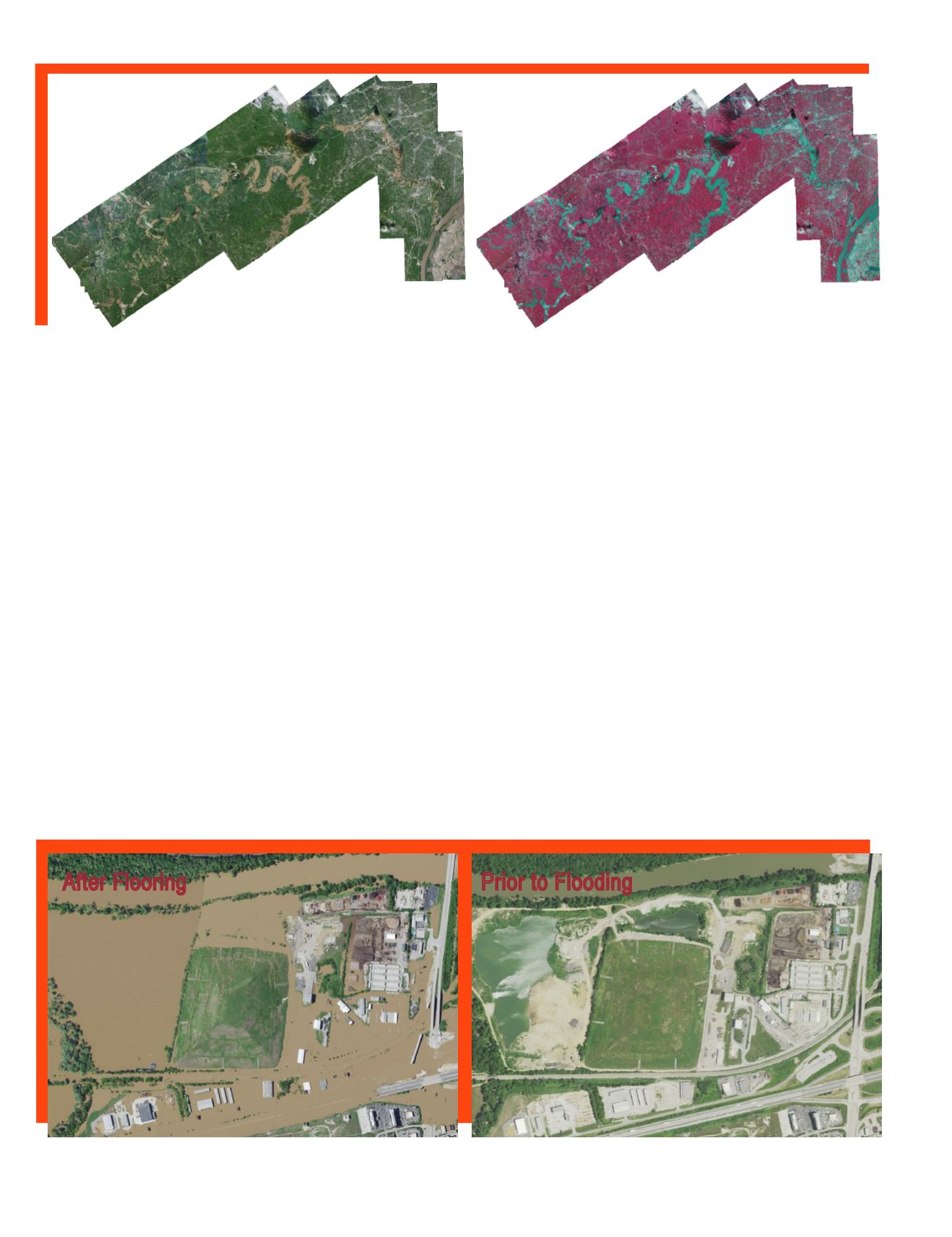
Of particular benefit is the use of previous imagery and/
or geospatial data to present a before – and after – view of
the flood. For example, other image layers can be “swiped”
against the disaster imagery using a slider to expose imag-
ery prior to the flood to examine the extent of damage. This
presentation of the data is a simple, but powerful, means for
characterizing the situation.
Surdex exposed an image service that was used by Esri to
add to their ArcGIS Online service and also employed two
additional web services that were distributed to anticipated
users and news media outlets.
Final orthoimagery product in color (left) and color infrared (right) renditions. Some residual cloud/cloud shadow cover is present, but exhibiting very
little occlusion in flooded areas
An online image server allowed users to see an area prior to the flooding and during flood conditions to reveal the extent of the damage
After Flooring
Prior to Flooding


