750
December 2018
PHOTOGRAMMETRIC ENGINEERING & REMOTE SENSING
SECTOR
INSIGHT:
.
gov
active fissures and flows. Their clarity illustrated the com-
plex evolution of the lava channel and surrounding flow field,
which provided critical information for hazard assessment
and improved understanding of the processes within flows
that drive expansion of their margins. These insights allowed
the thermal maps to be useful for both geologists and the pub-
lic in understanding the behavior and trend of the lava flows.
These satellite and helicopter-based remote sensing methods
have been part of HVO’s eruption monitoring toolbox since
before the onset of the eruption in May, but new techniques
were also brought into play for the 2018 eruption. For the
very first time in the United States, unoccupied aerial sys-
tems (UAS) were used to track an eruption from start to fin-
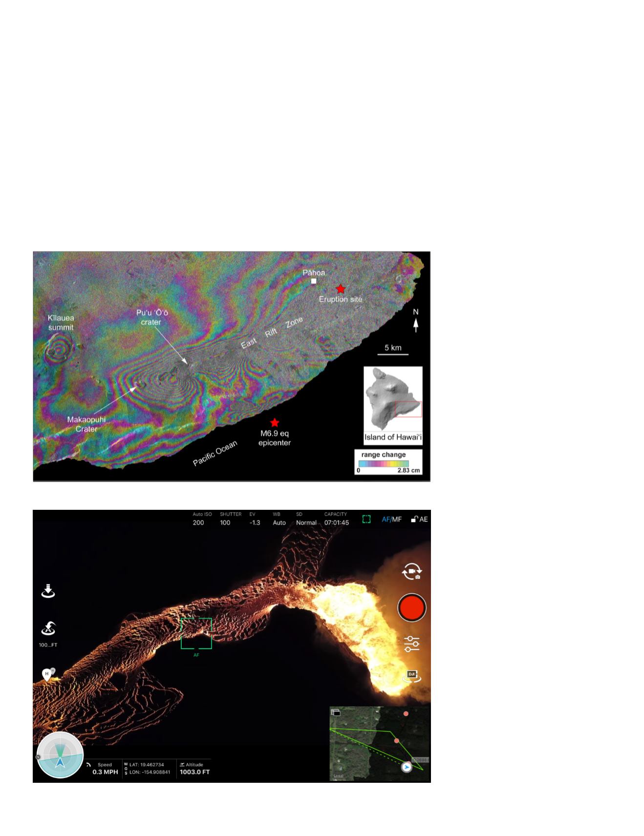
Figure 1. Sentinel-1 interferogram
showing ground deformation along
the East Rift Zone of Kīlauea from
23 April through 5 May 2018. Each
“fringe” – the span from one band of
each color to the next band of that
same color – represents 2.8 cm of
change in the distance between the
ground and the satellite. Strong sig-
nals from the Kīlauea summit, Maka-
opuhi Crater, and Pu‘u ‘Ō‘ō indicate
deflation associated with the evacu-
ation of magma downrift (eastward).
Fringes extending north from the town
of Pāhoa result from the intrusion of
magma around the eruption site in
Leilani Estates, and fringes along the
southern coastline result from a M6.9
earthquake on 4 May 2018. Sentinel-1
data are courtesy of the European
Space Agency, and additional sup-
port for SAR data acquisition was pro-
vided by the Hawaii Supersite.
Figure 2. Still image from a USGS UAS
video over a velocity measurement
point in the lava channel from fissure
8 (vent shown at right). In this image,
the field-of-view is ~500 meters by
~300 meters.
ish. Colleagues from the University of Hawai‘i campuses in
Hilo and Mānoa had previously tested these methods when
a 2014 Pu‘u ‘Ō‘ō lava flow threatened the town of Pāhoa,
3
and they were the first to deploy in Leilani Estates during
early May 2018. Later on, as the eruption became more vigor-
ous and inundated larger expanses, USGS offices around the
country sent UAS teams to help monitor the lava. These UAS
teams were tasked with various emergency response and sci-
entific objectives, from surveying destroyed property to sam-
pling volcanic gas where ground access was too dangerous.
During the eruption, UAS proved especially capable when mon-
itoring specific locations over long periods of time. Despite using
UAS models that were unable to fly longer than about 25 min-


