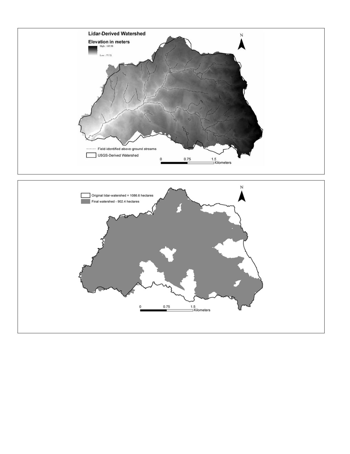
lidar-derived watershed area was 1,086.6 hectares. After add-
ing and subtracting land area throughout this analysis, the total
corrected area is 902.4 hectares, a difference of 16.9 percent.
More important than total watershed land area is the alteration
of the watershed boundaries; boundaries determine the actual
land area necessary for stormwater management and other best
management practices related to urban water quality.
Some areas of the watershed still needs field analysis. In
several locations, the watershed boundary crossed over roof-
tops, both flat commercial buildings and angular roofs of resi-
dential buildings. Even with our high-resolution aerial photos,
we were unable to determine how stormwater was collected or
redirected from each of these rooftops. As such, each building
would need to be evaluated for its management of stormwater
flow. In addition, it is not clear from the stormwater network
shapefiles and aerial photos whether or not one specific area
actually added or removed land area from the watershed
(Figure 5, the northwest-pointing U-shaped stormwater facil-
ity, represents a parking lot). We were unable to address this
specific area within our remote geospatial analysis.
Conclusions
For our small, highly urbanized watershed, one-meter
2
resolu-
tion lidar-delineation of a watershed only slightly changed
the watershed area as compared to the
USGS
manual interpre-
tation using a topographic map. The difference in area was
only 2.6 hectares. For those locales, with physical characteris-
tics similar to the Flatlick Branch of the Cub Run watershed,
that do not have lidar available, this result demonstrates very
little difference in area between ten-meter
2
and one-meter
2
resolution elevation models. Thus, lidar, although preferred,
Figure 6. USGS-derived watershed (bold black outline) overlaid on the lidar-derived watershed.
Figure 7. Watershed area (gray) after removal of catchment areas delineated from stormwater network facilities, pipes, and inlets, and
adding additional land areas contributing water flow from outside the original lidar-derived watershed boundary. Bold black outline is the
original lidar-derived watershed.
370
May 2015
PHOTOGRAMMETRIC ENGINEERING & REMOTE SENSING


