PHOTOGRAMMETRIC ENGINEERING & REMOTE SENSING
April 2018
175
QC
of
L
idar
S
ystem
C
alibration
and
D
ata
A
cquisition
using
A
bsolute
A
ccuracy
M
easurements
Introduction
The absolute accuracy of lidar data ideally must consider
the accuracy of all three dimensions of the data. Due to the
legacy of lidar data being used primarily for Digital Elevation
Models, only the vertical accuracy of the data are generally
reported. Another reason could be that in the initial years of
the development of the technology, the point spacing of the
data was low, and hence it was difficult to identify planimetric
features from the data with certainty.
H
owever, the applications of lidar data have grown tremen-
dously since the early days. It is not limited to being an input
to DEMs, and the data are used in solving many problems
which require their accuracy be known in all three dimen-
sions. Also, with the increasing use of return intensity data,
development of 3D feature extraction algorithms, increasing
point density, as well as increased computational resources, it
is possible to measure the accuracy of all three dimensions of
the data. Currently, the vertical accuracy of the data is mea-
sured on mostly flat, clear and open areas. However, these
measurements do not provide any quantifiable estimate of
the horizontal accuracy of the data set. However, there are
very few studies that have attempted to provide standardized
processes to measure the absolute accuracy. Some of these
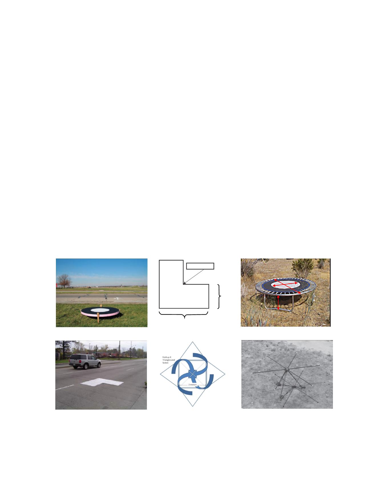
are mentioned below. These studies propose the use of spe-
cially designed 3D targets or intensity identifiable targets. In
Figure 2 below, example targets are shown and identified, as
such; the first row shows targets developed by the Ohio State
University for the Ohio Department of Transportation; the
second row depicts targets developed for Indiana Department
of Transportation and the third row depicts a 3D pyramid
shaped target designed by Jason Stoker of USGS and retro
reflector based on targets designed by the National Geospa-
tial-Intelligence Agency. However, deploying targets can be
expensive. Few, if any, of the studies have focused on the cost
of deploying such targets, which are assumed to be high based
on current costs of obtaining ground control points. Targets
deployed beforehand can also be inadvertently moved or tam-
pered with.
Recommendations for Further Research
The WG recommends that the following studies be
undertaken:
•
Cost of deploying targets as a percentage of total project
cost, project size, terrain conditions, etc.
•
Research on estimation of absolute three-dimensional
accuracy of lidar data using latest technologies, includ-
ing mobile lidar, static lidar, and UAV data.
Figure 1 Targets used in planimetric and vertical elevation assessment of lidar data.
2m
1m
Control Point


