characteristics; (b) Natural disaster management explaining
advantages, including thermal disasters, ground displace-
ment, floods; (c) Aquatic ecosystems management, mapping
and monitoring species, characterization of water bodies; (d)
Wildlife, bird and mammal detection. Whitehead and Hugen-
holtz (2014) described the progress and challenges in the use
of small
UAVs
in different environmental applications, includ-
ing photogrammetry, multispectral and hyperspectral imaging,
thermal, and synthetic aperture radar and lidar.
Considering the above classifications, paradigms and
topics, this paper provides a new point of view. Indeed, as
mentioned before, the overall goal is to provide an overview
of remote sensing applications based on
UAVs
equipped with
specific sensor-based technologies. With such a purpose,
the paper is structured as follows. The next section includes
aircrafts and x-copters, where ‘x’ can be quad, six, octo, and
heli, as typical platforms of
UAVs
used in remote sensing
applications. Different sensors and technologies, onboard
UAVs
, are also briefly described as instruments required for
such specific applications. Next, some remote sensing issues
related to collaboration, coordination, and cooperation as the
main topics in multi-
UAVs
for remote sensing applications, fol-
lowed by a wide set of remote sensing applications, becoming
an important contribution of this overview. Finally, the last
section contains the conclusions and future trends. The paper
is structured so that applications are independent; readers
interested in a specific area do not need to read the full paper.
The large number of references included in this overview
provides a suggestion of the importance and use of
UAVs
in
different application areas. We have preferred to provide
extensive references, so that the readers are provided with a
variety of topics of interest.
UAVs and Sensors: Onboard Capabilities and Technologies
The conjunction of unmanned platforms equipped with
sensors onboard allows for the realization of remote sensing
missions with applications in different areas. The Unmanned
Aerial Platforms Section displays typical platforms used
for such purpose. The Sensors and Technologies Section
describes different sensor-based technologies specifically
designed for remote sensing tasks.
Unmanned Aerial Platforms
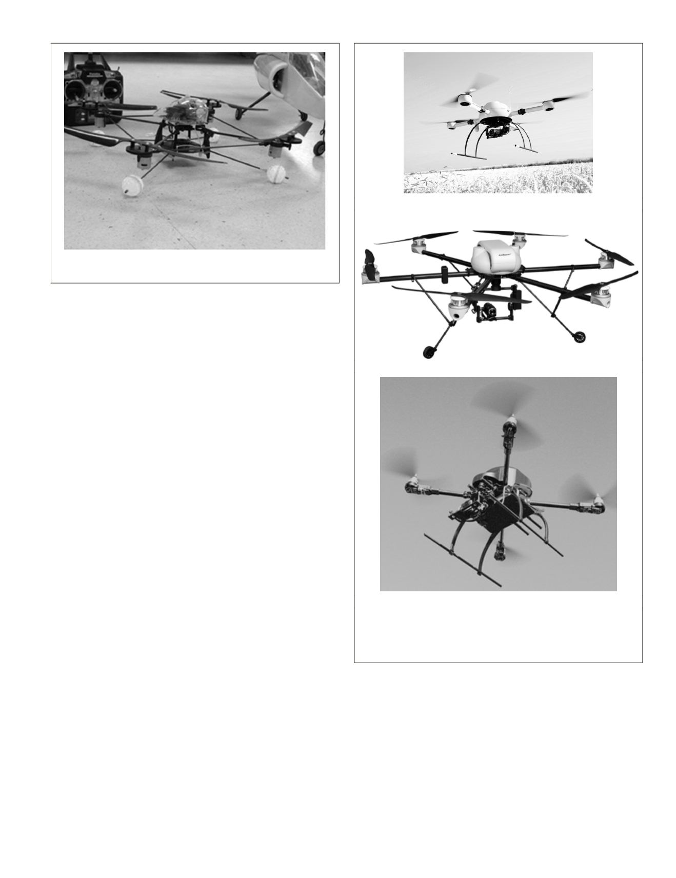
Figure 1 displays a quad-copter on the ground, with its remote
radio control system, used in collaborative missions together
with
USVs
(Courtesy of
ISCAR-UCM
Group (2015), Madrid,
Spain). Figures 2 (a) and (b) display two multi-rotors fly-
ing; they are a quad-copter (courtesy of Carto
UAV
, La Coruña,
Spain) (Carto
UAV
, 2015) and a hexa-copter, respectively,
(courtesy of AirRobot GmbH, Arnsberg, Germany) (AirRobot,
2015), used for weed patches detection in agriculture in the
context of the
RHEA
(2015) project. Figure 2(c) displays a quad-
rotor equipped with a multipurpose visible camera (courtesy
of eDroniX, Madrid, Spain) (eDronix, 2015). Figure 3 displays
two fixed-wing
UAVs
, the Cropsight and Viewer (courtesy of
QuantaLab-
IAS
-
CSIC
, Cordoba, Spain) equipped with multispec-
tral and hyperspectral, including thermal, sensors and used in
airborne campaigns for biomass analysis, based on chlorophyll
or carotenoids content, in vineyard, citrus, peach and olive
(a)
(b)
(c)
Figure 2.
uav
multi-rotors: (a) quad-copter (Image courtesy of
Carto
uav
, La Coruña, Spain); (b) hexa-copter (Image courtesy of
Airrobot GmbH & Co., Arnsberg, Germany) and (c) quad-copter
(Image courtesy of eDroniX, Madrid, Spain)
Figure 1.
rpa
system with the remote control system (Image cour-
tesy of
iscar
-
ucm
Group, Madrid, Spain).
PHOTOGRAMMETRIC ENGINEERING & REMOTE SENSING
April 2015
283


