on thin-metal oxide technology, for humanitarian demin-
ing, which is sensitive to different volatile compounds. This
device is installed onboard a blimp built with a hull filled
with helium. It is 4.5 m long, with 1.2 m diameter, and 6 m
3
of volume, with a payload of approximately 3 kg.
Gas emissions come from different activities. Indeed,
greenhouse is an emerging activity in agriculture with gas
emission. Methane is a gas flowing in gasification plants or
refineries. Regarding gas detection with
UAVs
, Khan
et al.
(2012a and 2012b) proposed a
VCSEL
(vertical cavity surface
emitting laser) sensor for measuring H
2
O, CO
2
, and CH
4
in
greenhouses based on Wavelength Modulation Spectroscopy
(
WMS
); the device is installed onboard a helicopter with
payload capacity of up to 5 kg. The
UAV
is 133 cm long, 41
cm high, has a main rotor diameter of 156 cm, with a flying
mass excluding payload of approximately 4.7 kg. Malaver et
al. (2015) integrated a solar powered
UAV
(3 kg payload) with
wireless sensor networks (
WSN
) to measure concentrations of
CH4 and CO2 in greenhouses. The
UAV
was equipped with a
gas sensing system based on nanostructured metal oxide and
non-dispersive infrared sensors.
Volcanic gases were measured at La Fossa crater, Vul-
cano Island (Italy) by McGonigle
et al.
(2008) with an
UAV
flying through the plume and equipped with an ultraviolet
spectrometer for the SO
2
flux and a multi-gas sensor system
consisting in a non-dispersive CO
2
-H
2
O infrared spectrometer,
an electrochemical SO
2
-H
2
S sensor, and a H
2
semi-conductor.
Different ratios of CO
2
/SO
2
are measured. This multi-gas sen-
sor technology was also installed onboard an
UAV
for analyz-
ing volcanic gas compositions of Shinmoedake, Kirishima
(a)
(b)
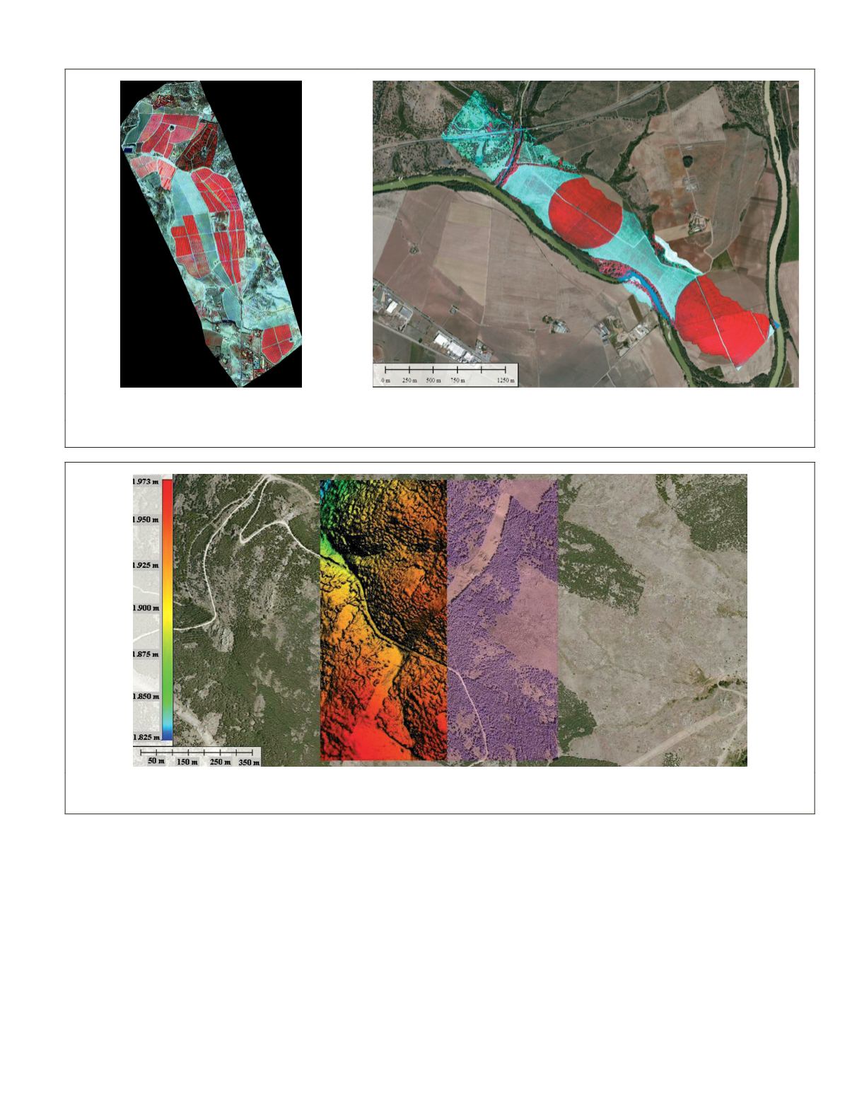
Plate 3. (a) Multispectral image, (b) hyperspectral image (Images courtesy of QuantaLab-
ias
-
csic
, Cordoba, Spain).
Plate 4. Four strips obtained from a
cir
system: Left and right strips represent
rgb
images; left central strip is a
dsm
, with the associated color-
bar representing heights; right central strip represents the
rgb
plus the
ir
channel. (Image courtesy of QuantaLab-
ias
-
csic
, Cordoba, Spain)
PHOTOGRAMMETRIC ENGINEERING & REMOTE SENSING
April 2015
289


