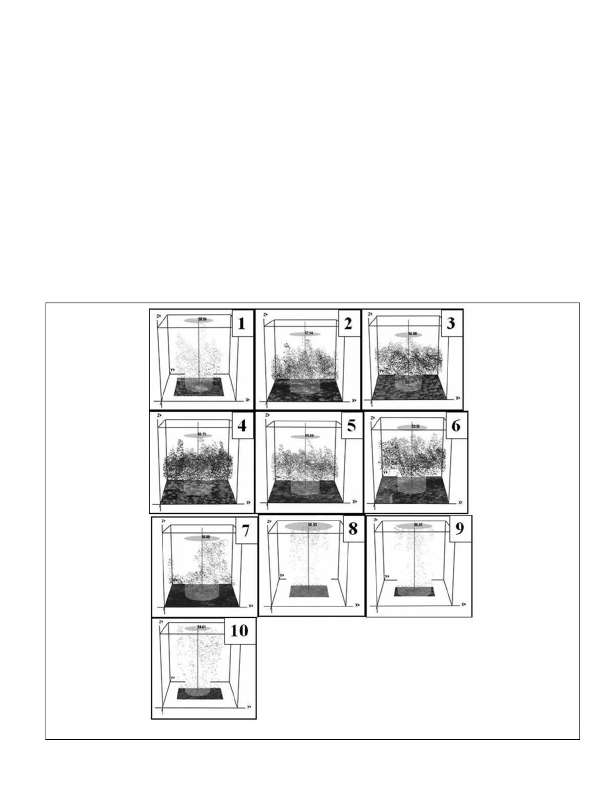
original lidar point cloud, the potential tree sites were validat-
ed to ensure that the features were natural and not man-made.
The top ten sites were all located in the northwestern
portion of the park (Figure 5). Sites were defined as groups
of more than two points within a 10 m radius with
z
-values
between 52 m and 60 m and ranked by the maximum height
value found in each site cluster. These potential tall trees
were mapped according to their
UTM
coordinates, and these
coordinates were loaded onto a hand-held Garmin Etrex
Vista HCx
GPS
unit for field verification. On 12 March 2012,
six sites (Sites 5 through 10) were visited and tall trees were
measured using an Impulse 100 clinometer and rangefinder
based on the methodology described by Andersen
et al
.
(2006). Three measurements were taken for each tree at each
site to obtain a mean field height to be compared to the lidar
predicted heights from the dataset. On 13 March 2012, an
attempt was made to access the remaining four potential
sites (Sites 1 through 4), but due to extreme topography and
a flooded creek channel, only one site (Site 3) could be ac-
cessed. Ground photos were taken to document the trees as
well as to show the terrain conditions of the potential tall tree
sites. Once the fieldwork was completed, further examination
and verification of each tree site was performed using the US
Forest Service FUSION lidar utility tool, which measured
the tallest points in the data set at each site. The examination
served as a check to ensure that the points were associated
with tree crowns. The FUSION tool allowed for the visualiza-
tion of the point clouds at each site in three dimensions, visu-
ally verifying that each site contained tree features.
Results and Discussion
A total of 1,523 discrete points were identified from the lidar
data with heights above ground of greater than 51.8 meters.
The top ten heights were chosen and ranked based on the
assumption that ten sites could be visited in a two-day field
study window. All ten sites were located in the Northwestern
portion of the park (Figure 5). It should be noted that the exact
location of these trees is ecologically and historically sensitive
information and can only be obtained by request to the
NPS
.
The range in heights of trees at these ten sites is roughly
55 m to 59 m, all higher than the 52.7 m tulip poplar previ-
ously listed as the tallest tree recorded in the Tennessee
portion of the
GRSM
as of May 2011 (Table 3). This finding
justifies further investigation by qualified arborists for
in
situ
height verification. The measurements of the ten sites
conducted in the field yielded results of varying errors, from
an underrepresentation by the lidar data of 30 percent to an
Figure 6. Representation of the highest point detected in the point cloud at Sites 1-10 with image plate (measurements are in meters)
PHOTOGRAMMETRIC ENGINEERING & REMOTE SENSING
May 2015
411


