areas with trees and grass (Plate 1) than in areas with build-
ings and roads; thus, method refinement influenced the natu-
ral areas less significantly. A reason for such outcome is that
natural objects, typically trees, are irregularly shaped and sel-
dom produce long straight lines. Another reason is that if long
straight lines exist in the natural areas because of incorrect
straight-line detection, the “born-by” constraint formulated as
Equation 9-2 would prevent unexpected
IPSL
-neighborhood
and incorrect segment merging. In the road and building
areas, the OPs were often regular in shape and produced rela-
tively long straight lines. The inner details of the buildings
sometimes caused separated segments, i.e., over-segmentation
errors. However, their straight boundaries (edge lines) were
possibly detected completely. After
IPSL
-neighborhood rela-
tionships were detected,
IPSL
-neighbors with merging costs
less than
T_SL
were merged; thus, over-segmentation errors
were reduced (Plates 1 to 3).
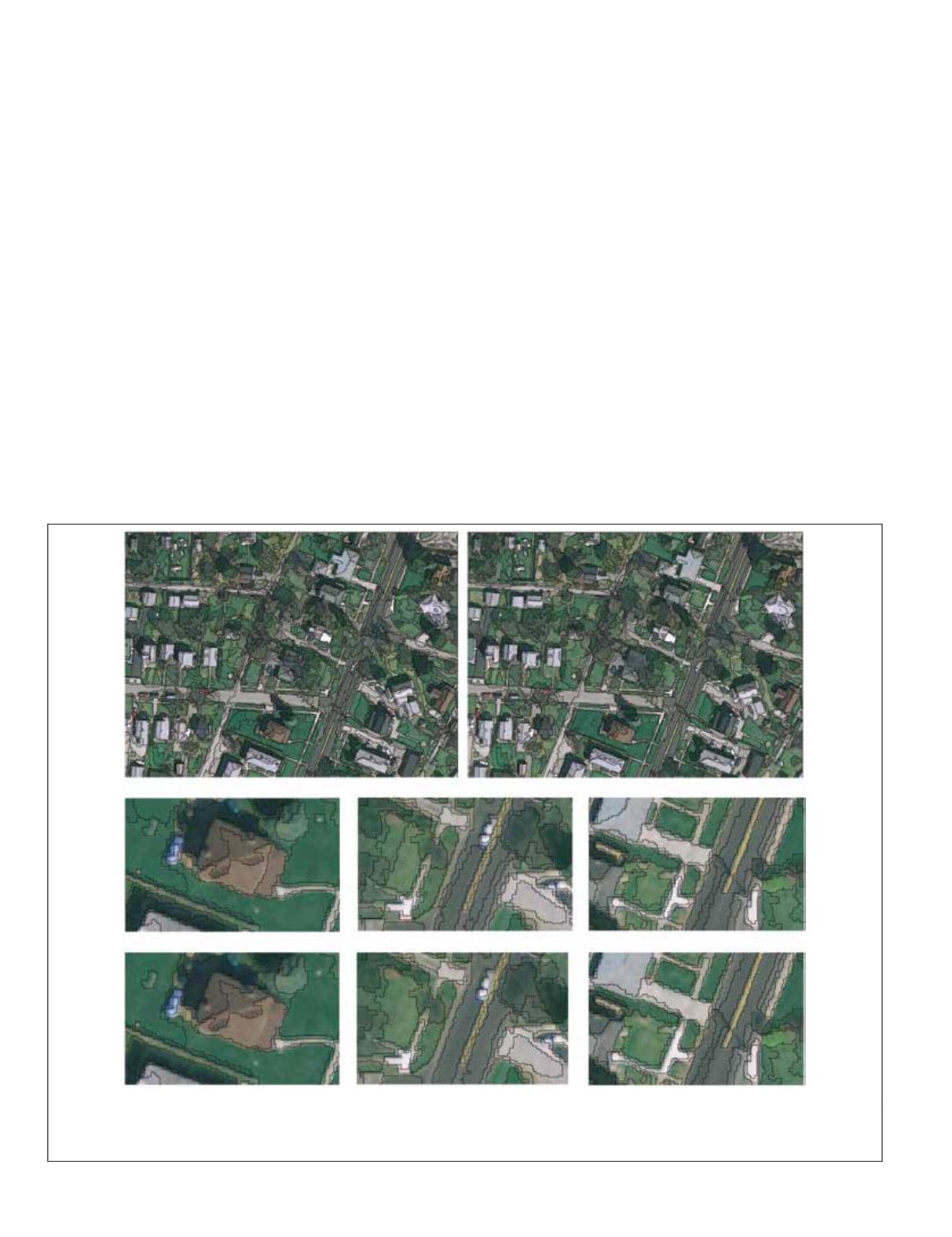
We analyzed the zoomed-in version of Plate 1 (Plate 2) and
further discussed the method principle and processes. In the
building shown in Plate 2a, the upper part is over-segmented
into segments 1 and 2. Considering that segment 1 is rela-
tively large, segment 1 could not be merged under scale 20 in
HBC-SEG
. Similar results were obtained in the shadow labeled
as segment 3. Given that a straight line along the northeast/
southwest direction is presented in the low-right boundar-
ies of segments 1 and 2 and that the merging cost between
the two segments is less than the power of
T_SL
, the two
segments were merged correctly into a single segment in the
refined method at scale 10. A similar analysis was applied to
shadow segment 3 in this plate. In Plate 2b, the grassland is
separated into several sub-segments that could not be merged
at scale 20 in the original method. The sub-segments satisfy
the
IPSL
-neighborhood relationship, with the merging cost
less than the threshold; thus, the segments were merged into
an entire grassland (Plates 2b3 and 2b4). In Plate 2c, building
segment 1 and road segment 2 are positioned along the same
straight line but their merging cost exceeds the power of
T_
SL.
These segments were not merged in both the original and
refined methods. The merging costs of segments 2 and 3 with-
in the road exceed 20 × 20 and could not be merged in the
original method. However, given that they are
IPSL
-neighbors
and have a relatively small merging cost that is less than the
power of
T_SL
, they were correctly merged at scale 10 in the
refined method. These analyses show that the refinement step
is guided by both scale parameter
T_SL
and the
IPSL
-neighbor-
hood constraint, which effectively reduced over-segmentation
errors. Additional correct merging instances are marked with
boxes in Plates 1e, 3c, and 3d for further investigation. When
T_SL
alone was utilized to control the merging, several obvi-
ous under-segmentation errors were observed at scales 40 and
50 (the segments of man-made objects at this scale grew to
sizes similar to that in Plate 1i) within the man-made objects,
as illustrated in Plates 1f and 1g. Compared with the original
HBC-SEG
, the refined method can reduce over-segmentation
errors at comparable (typically the same) scale levels by un-
dertaking a very small risk of under-segmentation errors.
(a)
(b)
(c)
(d)
(e)
(f)
(g)
(h)
Plate 4.
fnea
at comparable scales with the default input settings of eCognition-5. The first row presents the entire segmentation results
at scales 40 and 50 in Area 1. The second and third rows present the zoomed-in results of FNEA at scales 40 and 50, respectively, cor-
responding to Plates 2a, 2b, and 2c.
404
May 2015
PHOTOGRAMMETRIC ENGINEERING & REMOTE SENSING


