Examining the
NLCD
and urban maps at the 692
re-interpreted ground reference sample points
found along rural roads indicates that a higher
percent of developed land mapped by
NLCD
in 2001
and 2006 intersects rural roads (40 percent and
46 percent, respectively) than the 2001 and 2006
urban maps (3 percent and 7 percent, respectively).
Only 23 rural road reference sample pixels were
misclassified in the 2001 urban maps, and only
50 rural road reference sample pixels remained
misclassified in 2006.
Table 2. Level III ecoregions with the greatest total
area of developed land in 2011
NLCD
and the greatest
total area of urban land in the 2011 urban map.
Ecoregion Name
Eco #
NLCD 2011
Developed Area (km
2
)
Southeast Plains
65
24,740
Piedmont
45
21,706
South Coastal Plain 75
18,144
West Corn Belt
Plains
47
15,918
CA Oak Woodlands
6
15,817
Central Great Plains 27
14,746
Ridge and Valley
67
13,883
Central Corn Belt
Plains
54
13,656
West High Plains
25
12,927
East Corn Belt Plains 55
11,625
Ecoregion Name
Eco #
Urban 2011
Area (km
2
)
South Coastal Plain 75
14,041
Piedmont
45
13,700
CA Oak Woodlands
6
12,630
Southeast Plains
65
10,194
Central Corn Belt
Plains
54
8,799
Northeast Coastal
Zone
59
8,470
Ridge and Valley
67
7,795
MI/IN Drift Plains
56
7,593
East Corn Belt Plains 55
7,310
North Piedmont
64
6,678
Discussion
Trends in area of developed land reported by dif-
ferent studies show considerable variability (Figure
6). The inclusion of roads in the developed class of
NLCD
and the way that
BTS
road data were used to
map developed land result in much higher areas of
developed land in
NLCD
relative to
USGS
Land Cov-
er Trends (
LCT
) (Sleeter
et al
.
,
2013) data, the
USDA
National Resource Inventory (
NRI
) (US Department
of Agriculture, 2013), the
USDA
Economic Research
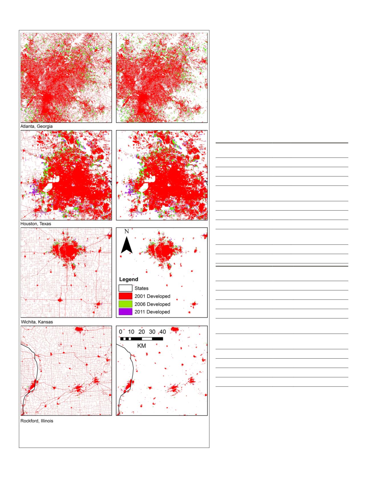
Figure 5. Comparisons between
NLCD
developed class (left panel) and
the new urban maps (right panel) for four urban areas in the United
States. Three dates are shown (2001, 2006, and 2011).
106
February 2018
PHOTOGRAMMETRIC ENGINEERING & REMOTE SENSING


