626
September 2019
PHOTOGRAMMETRIC ENGINEERING & REMOTE SENSING
Rising Star
ASPRS
PROGRAM
Meet Our
Rising Stars!
Chris Stayte
Sponsored by Woolpert, Inc.
Corey Ochsman
Sponsored by Woolpert, Inc.
Collin Hutcheson
Sponsored by
Merrick & Company
Charles Krugger
Sponsored by
Stahl Sheaffer Engineering, LLC
Kristine Taniguchi-Quan, Ph. D.
Sponsored by
Pacific Southwest Region
of ASPRS
S
ponsors
ASPRS Corporations, Regions, Member Groups, and Individual Members are all eligible to sponsor a Rising
Star or multiple Rising Stars.
C
osts
• Membership: $150 annual membership fees for the Rising Star
• Time and Travel Expenses up to $1000 per year including time and travel for the Rising Star to attend
the ASPRS Annual Conference and participate in ASPRS Technical Division activity throughout the
year.
B
enefits
• Listing in
PE&RS
Journals for the entire time of sponsorship to include Sponsor Name and the list of
the Rising Star members supported by each sponsor.
• Feature Article – One Rising Star will be featured with a
PE&RS
Highlight Journal Article every three
months.
R
ising
S
tars
Be a part of setting the direction of the geospatial profession by contributing your expertise and energy,
by guiding industry and professional practice standards, specifications, and by leading, training, and
encouraging others to appreciate and apply new mapping and remote sensing technologies.
Sponsor One Rising Star Today and
Make a Difference for Tomorrow
S
ponsorship
and
M
entorship
ASPRS’ Rising Star program is established to advance geospatial science through a sponsorship and
mentorship program for early career professional and student members.
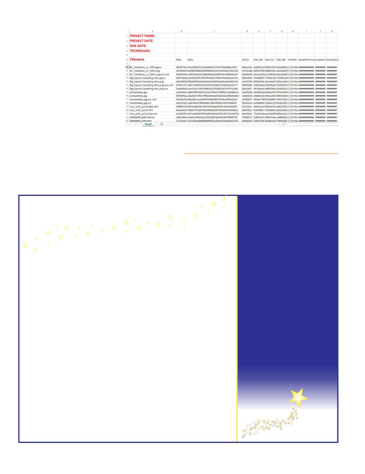
called, HashMyFiles. The software is
Microsoft Windows compatible and
runs relatively efficiently. A 4-gigabyte
(GB) lidar file is hashed in under four
minutes, and files under 1 GB are
done so almost instantly. The program
generates six hash codes, including
SHA1, MD5, CRC32 (which can also be
generated by Windows 10), SHA-256,
SHA-512, and SHA-384. The report
also tracks the full path name of the
file, as well as several other attributes
of each file. The output report is in a
standard ASCII format that can be
copy and pasted into either a simple
text document or an Excel spreadsheet.
In this example, I added an entire
folder containing 150 files in five
subfolders (844 MB of Esri shapefiles, GeoDatabases .JPG
image files, etc.), and checked the “Add files in subfolders”
box on the navigation screen because there were Esri file
Geodatabases in the directory, and started the processing.
Name and store the Excel spreadsheet along with your project, and you now have a secure
chain-of-custody to protect your work. I’ll be happy to send you a ZIPped archive containing
the NirSoft freeware, a little ReadMe document, and an Excel template.
Al Karlin, Ph.D., CMS-L, GISP is with Dewberry’s Geospatial
and Technology Services group in Tampa, Florida. As a Senior
GIS Professional, he works with all aspects of Lidar, remote
sensing, photogrammetry, and GIS-related projects.


