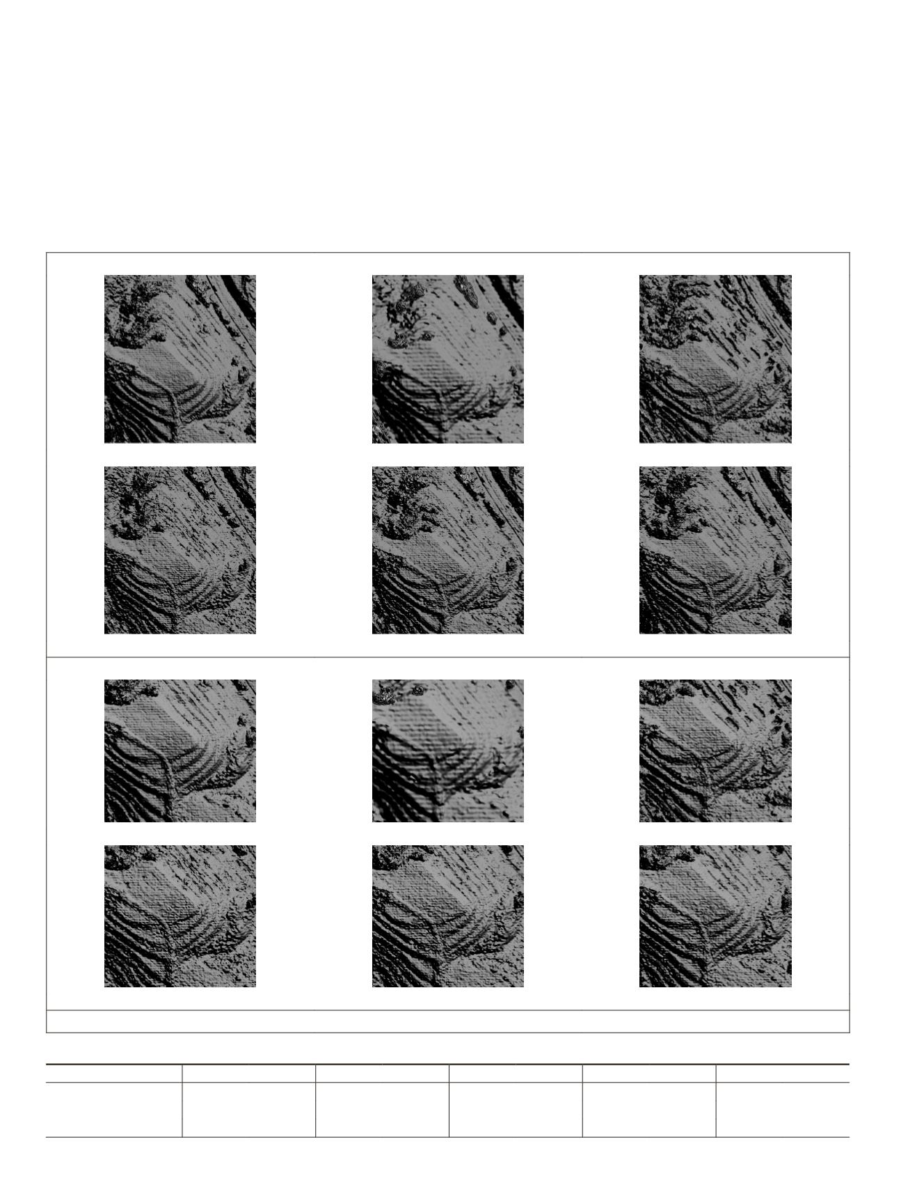
Considering that dense matching algorithms always failed
at forested terrains, which might result in unknown elevation
deviation and abnormal
RMSE
, we removed most of vegetation
covered areas from region B in Figure 4 to see whether the
abnormal
RMSE
situation could be partially solved. The new
experiment region is shown in Figure 5, and the quantitative
results are in Table 3. As displayed in Table 3, the
RMSE
results
had improved a lot after removing vegetation covered area,
which explained the abnormal
RMSE
situation in Figure 4.
Moreover,
VDSR
and
SRMD
were regarded as two differ-
ent optimizing strategies of the basic
CNN
-based
SR
model
(
SRCNN
) in this paper, of which the former tried to add layers
and adjusted network architecture while the later focused
on exploring image degradation formula. The experimental
results shown in Table 2 confirmed that when the
SR
model
was optimized, the
DSMs
quality could be improved. That is
to say, compared to directly
DSM
upscale, a more satisfactory
subpixel level
DSM
could be obtained with a
CNN
-based
SR
model. Furthermore, by optimizing the
SR
methods, the
DSM
Reference
DSM UPSCALE
Bicubic
SRCNN
VDSR
SRMD
I: Region B in Figure 4
Reference
DSM UPSCALE
Bicubic
SRCNN
VDSR
SRMD
II: remove vegetation area from Region B
Figure 5. The experiments to determine the reason of abnormal
RMSE
.
Table 3. Quantitative evaluation of experiments in Figure 5.
Methods
DSM UPSCALE
BICUBIC
SRCNN
VDSR
SRMD
Regions (region size) RMSE(m) MRE/% RMSE(m) MRE/% RMSE(m) MRE/% RMSE(m) MRE/% RMSE(m) MRE/%
I: (892 * 806)
82.1113 6.36 87.9862 8.77 53.9941 3.79 46.4107 3.02
35.7335 1.91
II: (668 * 626)
29.8961 1.18 48.7352 3.55 24.1997 0.96 18.5257
0.7
16.8759 0.69
772
October 2019
PHOTOGRAMMETRIC ENGINEERING & REMOTE SENSING


