“
SRCNN
-
DSM
”, “
VDSR
-
DSM
”, and “
SRMD
-
DSM
”. And all the
DSMs
obtained from
CNN
-based
SR
models were denoted as “
SR
-
DSMs
”.
Generally, it was obvious that the
CNN
-based methods
could generate better subpixel level
DSMs
in any terrain situ-
ations compared to directly
DSM
upscale from Table 2. And
the results in Figure 4 also showed that the
DSMs
obtained
from the proposed method had higher fidelity and contained
more terrain details. Besides, as the
SR
-
DSMs
were obtained
from higher-resolution image pairs, there were less mismatch
compared to the directly
DSM
upscale results.
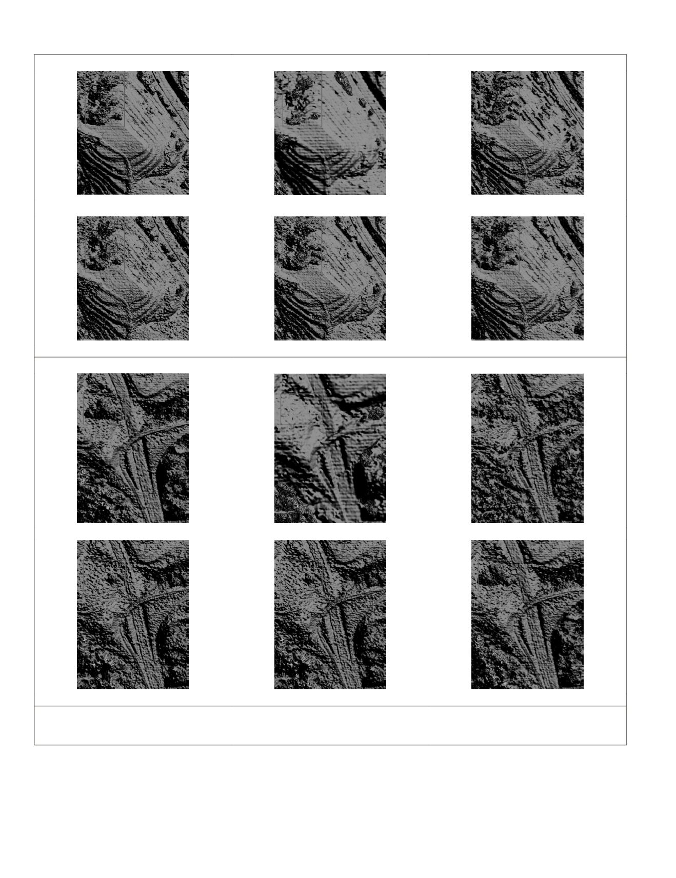
For the sake of comprehensiveness, both subjective and objec-
tive evaluations were taken into consideration for analysis. Sub-
jectively, in Figure 4, the selected four regions could be mainly
divided into three parts: building areas (region A), nonbuilding
Reference
DSM UPSCALE
Bicubic
SRCNN
VDSR
SRMD
Region B: mountain area (the red box: forested areas)
Reference
DSM UPSCALE
Bicubic
SRCNN
SRMD
Region C: a main road area (the red box: forested areas)
Figure 4
continued
. Comparison of generated
DSMs
from different methods in five regions of several different types of terrain.
(Region A is a building region, region B is a mountain region, region C is a main road region, and region D is a special region
which contained mismatch).
Concluded on next page.
770
October 2019
PHOTOGRAMMETRIC ENGINEERING & REMOTE SENSING


