obtained in Experiment D compared to Experiment B. Fur-
thermore, the systematic errors in the planimetry presented in
Experiments A and B were significantly lower in Experiments
C (Figure 7c) and D (Figure 7d), which considered boresight
correction. Systematic errors were not detected in the altim-
etry in Experiments C and D.
The comparison between the results obtained in Experi-
ments C and D demonstrates the impact of the
LSM
adjustment
considering a point cloud corrected for boresight errors, espe-
cially in the altimetry. An
RMSE
of 12.7 cm for the altimetry was
obtained in Experiment C, and that in Experiment D was 10 cm.
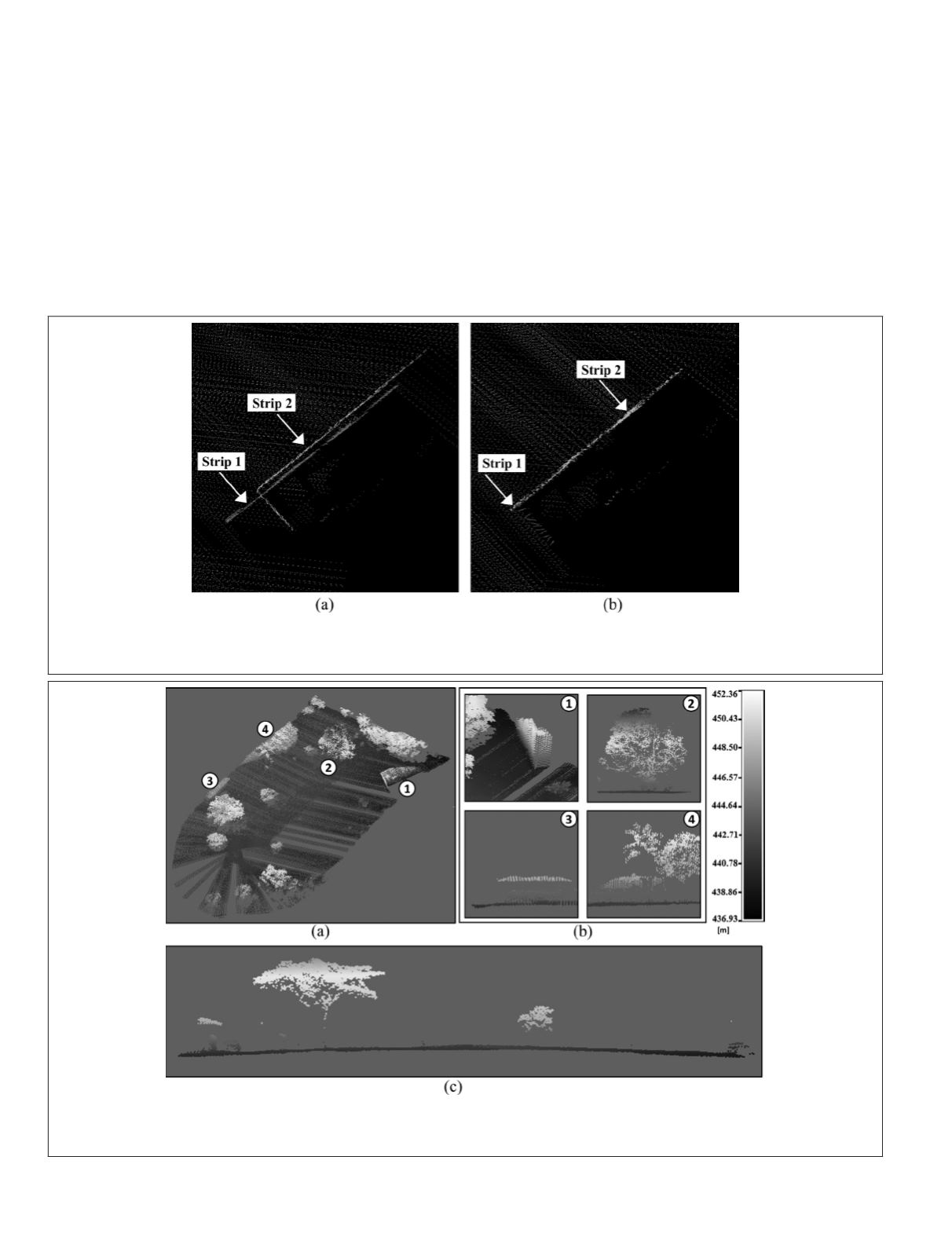
Figure 8 shows the comparison between point clouds with-
out (Experiment B) and with boresight-misalignment correc-
tion (Experiment D) around a feature (building) in the overlap
between two flight strips. The results were visualized and
analyzed in CloudCompare. Figure 9 depicts the final point
cloud from the test area from Experiment D, with an average
density of 11.65 points/m².
Conclusions
This article presented a postprocessing synchronization
technique used to correlate the clocks of decoupled devices
comprising a lightweight
ALS
aboard a
UAV
. The technique is
an alternative when electronic time synchronization between
sensors cannot be performed or in cases of failure due to
device communication problems. The postprocessing tech-
nique achieves a synchronization precision of 0.7 ms. The
Figure 8. A point-cloud feature (building) in an overlay area of two strips, showing the mismatch of points from the same
feature due to misaligned errors. (a) The point cloud generated with synchronization only (Experiment B). (b) The point
cloud obtained with boresight-angle correction (Experiment D).
Figure 9. Lidar point cloud generated with the time-synchronization technique using correlation between signals, boresight-
angle correction, and refinement by the least-squares method. The perspectives correspond to (a) tridimensional view and (b)
lateral profiles containing buildings and trees.
762
October 2019
PHOTOGRAMMETRIC ENGINEERING & REMOTE SENSING


