Surveying and mapping technologies have advanced tremen-
dously over the last century, resulting in improved product
accuracy. Yet some antiquated practices and processes con-
tinue, as if they are frozen in time. This article will focus on
an outdated practice that needs to be addressed: the way we
evaluate the positional accuracy of geospatial products.
Before detailing this problem and introducing the correct
approach, we should establish a basic understanding of how
to determine and report product accuracy, geometric datum,
and what that datum represents. To understand the datum,
one needs to know how we deal with the shape, or figure, of
the Earth.
F
igures of
the
E
arth
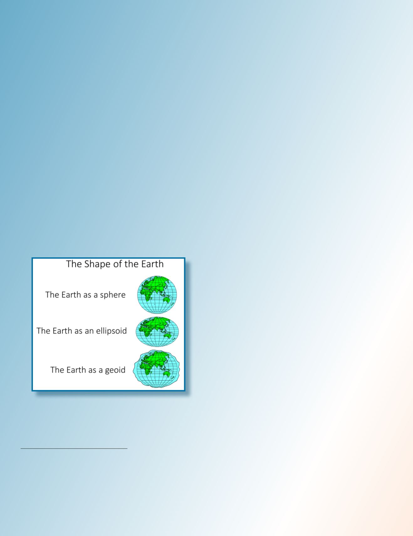
The physical surface of the Earth is the shape we attempt to
model through our mapping or surveying practices. However,
because of irregularities on the Earth’s surface and the lack
of a comprehensively surveyed model of that surface, several
geometrically defined shapes are employed in our surveying
and mapping techniques to approximate the Earth’s surface
to determine specific geographic locations (Figure 1). These
geographic locations must be referenced by a well-known
system called a “datum.”
Earth as an Ellipsoid
An ellipsoid surface is obtained by deforming a sphere by
means of directional scaling, so it is the best shape to use to
approximate the Earth. The term datum is nothing but an el-
lipsoid with defined axes, curvature, a known origin in space
and axes rotation. Wikipedia defines the Earth ellipsoid as
“a mathematical figure approximating the Earth’s form, used
as a reference frame for computations in geodesy, astrono-
my and the geosciences.” Datum origin can be positioned at
any place in space. The origin of the NAD27 datum is at the
survey marker of the Meades Ranch Triangulation Station
in Osborne County, Kansas. Geocentric datum is a datum
with its origin positioned at the mass center of the Earth.
Examples of geocentric datums are the NAD83, ITRF and
WGS84—all of which are based on the GRS80 ellipsoid. All
surveying and mapping activities, including GNSS survey-
ing, determine how far a position on the Earth’s surface is
from the surface of a referenced ellipsoid or geoid.
Earth as a Geoid
A geoid represents the equipotential surface of the Earth’s grav-
ity and comes very close to mean sea level. Wikipedia defines a
geoid as “the shape that the ocean surface would take under the
influence of the gravity and rotation of the Earth alone, if other
influences such as winds and tides were absent.” Surveyors
traditionally present their height measurements in reference to
the geoid, i.e. how far that position is above or below the geoid
surface. Since the geoid surface is shaped by the same gravita-
tional force that causes water to flow downhill, people like to
survey elevations by referencing the geoid because those ele-
vations or slope directions align with that natural water flow.
Conversely, ellipsoidal heights measuring up or down slopes
may not match that water flow direction.
The True Physical Shape of Earth
The terrain around us is irregular and does not coincide with
either geoid or ellipsoid surfaces. Our surveying and map-
ping activities are solely conducted to represent the physical
figure of the Earth on a map or within a geospatial database
as it is referenced to the datum.
S
urveying
to
R
epresent
the
T
rue
D
atum
When we conduct field surveying, we are trying to determine
terrain positions and shapes in reference to a specific geodetic
datum. According to the U.S. National Geodetic Survey (NGS),
a geodetic datum is defined as “an abstract coordinate system
with a reference surface (such as sea level, as a vertical datum)
that serves to provide known locations to begin surveys and
create maps.” Because our surveying techniques, and therefore
our mapping techniques, are not perfect, our surveying results
are approximate positions that put us close to the true, da-
398
July 2020
PHOTOGRAMMETRIC ENGINEERING & REMOTE SENSING
Figure 1: Shapes of the Earth (Courtesy of Esri
documentations).
Photogrammetric Engineering & Remote Sensing
Vol. 86, No. 7, July 2020, pp. 397–403.
0099-1112/20/397–403
© 2020 American Society for Photogrammetry
and Remote Sensing
doi: 10.14358/PERS.86.7.397


