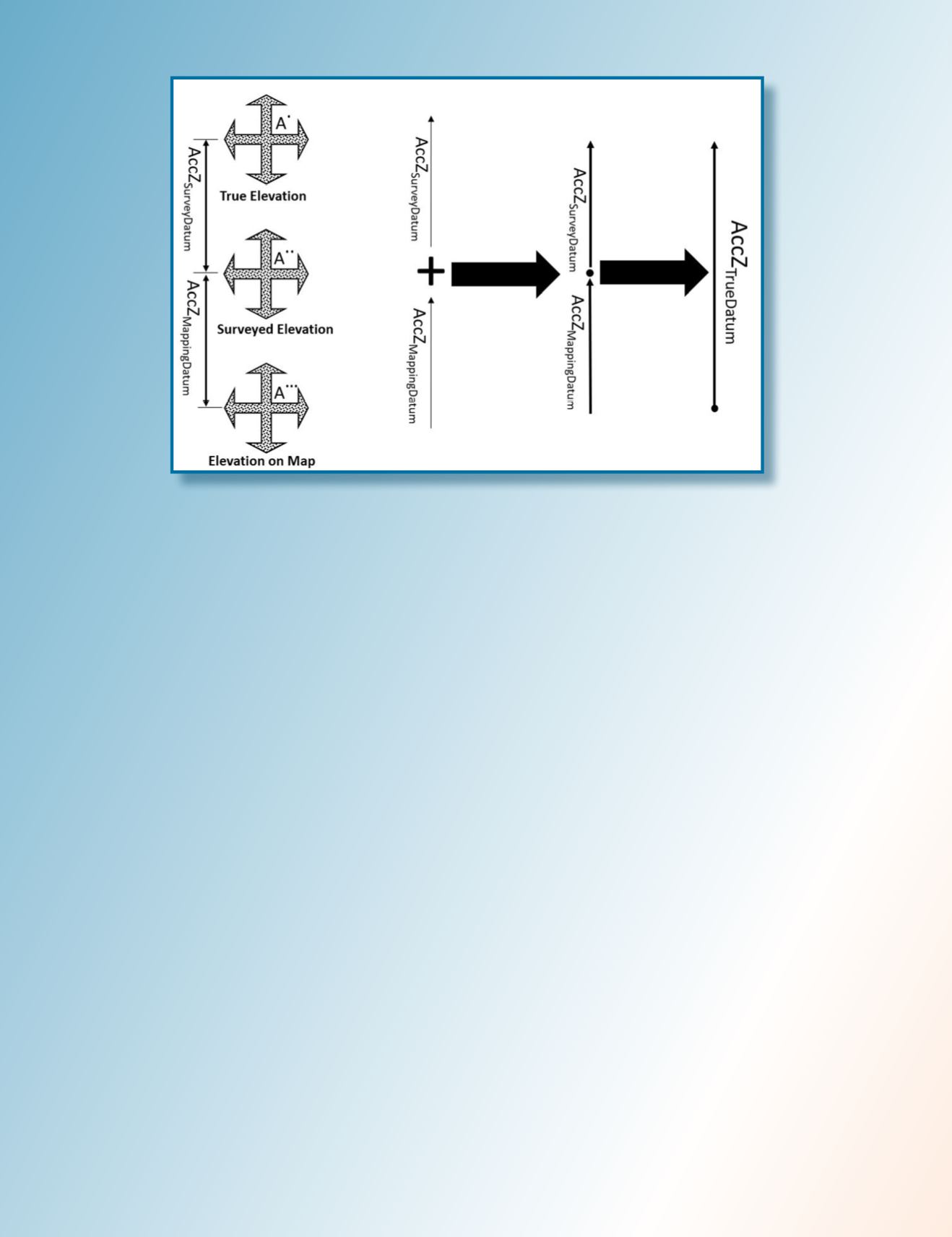
Figure 5: Influence of error propagation on point elevation accuracy.
R
emarks
and
R
ecommendations
The propagation of errors through the mapping process is
a well-known and well-practiced science in surveying and
mapping. However, due to the gradual evolution in mapping
technologies and mapping practices over decades of advance-
ments, users have become less sensitive to the fact that
surveying techniques are not perfect. Such insensitivity is
caused by the following simple facts:
1) The early days of mapping products were highly
inaccurate, and users ignored the errors caused by
inadequate surveying techniques. Earlier in the days
of digital mapping, the U.S. Geological Survey (USGS)
introduced the Digital Orthophoto Quadrangle (DOQ).
DOQs produced by the USGS cover an area measuring
7.5-minutes longitude by 7.5-minutes latitude (the
same area covered by a USGS 1:24,000-scale topo-
graphic map, also known as a 7.5-minute quadrangle).
The USGS also introduced second product that is
higher in resolution and accuracy than the DOQ called
the Digital Orthophoto Quarter Quadrangle (DOQQ),
with a scale of 1:12,000 in a format of 3.75-minutes by
3.75-minutes.
1
The horizontal accuracy of the DOQQ
at the time, according to the National Map Accuracy
Standard (NMAS), was equal to 10.1 meter (or 33.3 ft),
while our surveying techniques resulted in accuracy
to the sub-decimeter level. Surveyors and mappers at
the time were aware of this and intentionally ignored
errors caused by the surveying techniques when
deriving the accuracy of a mapping products, such as
what a 5cm to 10cm difference was going to add to
the 10-meter coarse accuracy of a product. However,
product accuracy improved gradually over time while
a new generation of surveyors and mappers were
likely still trained to ignore the errors in surveying
techniques. Over time, the entire mapping industry
became numb to this fact. Today, some mapping
products from terrestrial lidar, mobile mapping lidar,
UAS-based lidar, and some time photogrammetric
products from low altitude manned and unmanned
aircraft, if stringent production workflow is followed,
are accurate to sub-centimeter level. Such improved
accuracy presents a new challenge when it comes to
people with little or no photogrammetric or survey-
ing education or experience. The new UAS-opera-
tor-turned-mapper community is at the top of this list.
Oftentimes people are claiming sub-centimeter hori-
zontal and vertical accuracy from UAS products. This
claim has merit until you ask the mapper about the
technique used in surveying the ground control points
for aerial triangulation or lidar calibration or for the
independent surveyed checkpoints to verify this claim.
In most cases, these users either were not aware of
what technique that was used or, if they were aware of
it, it was an RTK survey. As mentioned earlier, RTK
survey results in 2cm to 3cm accuracy. The concern
here is how do you obtain a sub-centimeter accuracy
from a process that was controlled by ground control
surveyed to an accuracy of 2-3cm? This question
promptly ends that conversation. One may ask here,
how the aerial triangulation or lidar boresight/cali-
bration results in sub-centimeter accuracy while the
402
July 2020
PHOTOGRAMMETRIC ENGINEERING & REMOTE SENSING


