be to start with areas of an image that are actually cloud-free,
to apply the algorithm on the areas, and to compare results
with and without using the algorithm. If the assumption is
sound there should be little or no change to values in the
cloud-free areas. The algorithm was applied to cloud-free pix-
el of
IMG
NOV
. Scatter plots of Bands 1 through 5 were shown
(Figure 9a through 9e). The x-axis represented reflectance
value before the processing, and y-axis that after the process-
ing. The points were scattered near the 1:1 line (not shown in
Figure 9). In addition, the slope of each least-squared fitted
line was near 1, and the intercept was about 0. Thus, the
reflectance values did not change much after the algorithm for
cloud-free pixels. With
R
2
values greater than 0.78 (Figure 9),
one should conclude that the assumption was valid.
Comparison with Three Methods for Cloud Removal
The algorithms of homomorphism filter, IHS transform,
and wavelet transform were used to remove the clouds in
the subimage after the atmosphere correction, respectively.
Although the algorithms removed some clouds, the remaining
presence of clouds was still noticeable (Figure 10). Among the
three algorithms, the wavelet transform algorithm performed
the best, and the homomorphism filter algorithm performed
the worst. In comparison of the outputs from three algorithms
(Figure 10) with that from the developed method (Figure 6),
the method outperformed the three algorithms visually.
Spatial correlation coefficients of
IMG
NOV
and each cloud
removed image were given in Table 4. (The IHS transform
algorithm only output three components, intensity, hue, and
saturation that are related to reflectance in blue, green, and
red wavelengths. The coefficients were only for Bands 2, 3,
and 4.) Of cloud pixels, the coefficients ranged from 0.42 to
0.88 for the homomorphism filter algorithm, from 0.54 to 0.75
for the IHS transform algorithm, and from 0.43 to 0.87 for the
wavelet transform algorithm. As assessed by the coefficients,
the spatial correlation coefficients (of
IMG3
and
IMG
NOV
) from
the developed method (Table 3) were higher than those from
the three algorithms except for the coefficients of Band 5 us-
ing the homomorphism filter and wavelet transform algo-
rithms.
Applicability to other Land Use and Land Cover Types in Another Location
The algorithm was applied to another area located near north-
west of Los Angeles, California. The area was predominantly
urban, rolling hills of woodland, and agricultural land. Land-
sat-8 imagery was acquired on 08 January 2014. A subimage
of 1,100 (columns)× 1,100 (rows) was extracted. Thus, the
area was 33 km × 33 km, about 8 times larger than the study
area of Ziyang, China. Reflectance values of Band 2 is shown
in Figure 11a. Thin clouds exist near upper-left corner and
middle area. The image of Band 2 after the cloud removed
is given in Figure 11b. In comparison, the thin clouds have
been visually removed. The mean value and one standard
deviation of the reflectance values in each band are presented
in Table 5. The consecutive reduction in the reflective value
have been observed after the image are atmospherically cor-
rected, and thin clouds removed using Band 9 and then
QA
band. The pattern of the decrease is similar to what has been
reported in Table 1. The effectiveness in cloud removal is fur-
ther assessed using Landsat-8 image acquired on 23 December
2013 as the “truth” image. The December image is denoted as
IMG
DEC
. Spatial correlation coefficients of image pairs
IMG1
and
IMG
DEC
,
IMG2
and
IMG
DEC
,
and
IMG3
and
IMG
DEC
are given
in Table 6. For each band, the coefficients consecutively
increase from pair
IMG1
and
IMG
DEC
to pair
IMG3
and
IMG
DEC
.
Thus, the applicability of the developed algorithm to process-
ing a large image and to another location with different land
use and land cover types is satisfactorily proved.
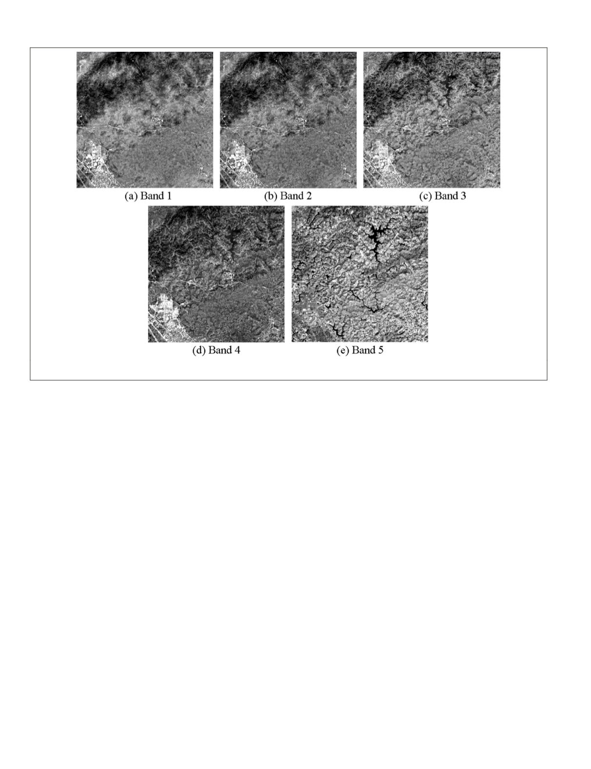
Figure 6. Reflectance values of
IMG3
that is after the cloud-removal using QA band: (a) Band 1, (b) Band 2, (c) Band 3, (d) Band 4, and
(e) Band 5.
726
September 2015
PHOTOGRAMMETRIC ENGINEERING & REMOTE SENSING


