Conclusions
After the correction of atmospheric effects on Bands 1 through
7 of Landsat-8 data, an algorithm to remove thin cirro- and
alto-clouds within Bands 1 through 5 was developed. In the
algorithm, cirrus clouds were first removed using Band 9. We
next assume that pairs of pixels with similar reflectance in
Bands 6 and 7 would also have similar reflectance in Bands
1 through 5. This assumption was validated after assessing
the difference without and with applying the algorithm to a
nearly cloud-free Landsat-8 image. Then, with the assumption
and coupled with the quality assurance (
QA
) band of Land-
sat-8, remaining thin clouds were further removed.
The algorithm was studied to remove thin clouds in a
Landsat-8 image of 129/39 (path/row) acquired on 16 Decem-
ber 2013. The Landsat image covered a portion of Sichuan
basin, China. Thin cirro- and alto-clouds were observed near
Ziyang, Sichuan Province. Then, a subimage consisting of
the thin clouds was extracted. After the execution of the
algorithm, the clouds disappeared visually within Bands 1
through 5. Reflectance values of visible Bands 1 through 4
decreased, and the values of Band 5 decreased first and then
increased slightly. With a nearly cloud-free image acquired on
30 November 2013 as the “truth,” the spatial correlation coef-
ficients of cloud-covered pixels within the December image
were 0.84 or higher. Changes in the reflectance values of
Bands 1 through 5, and the high correlation coefficient values
indicated the validity of the algorithm.
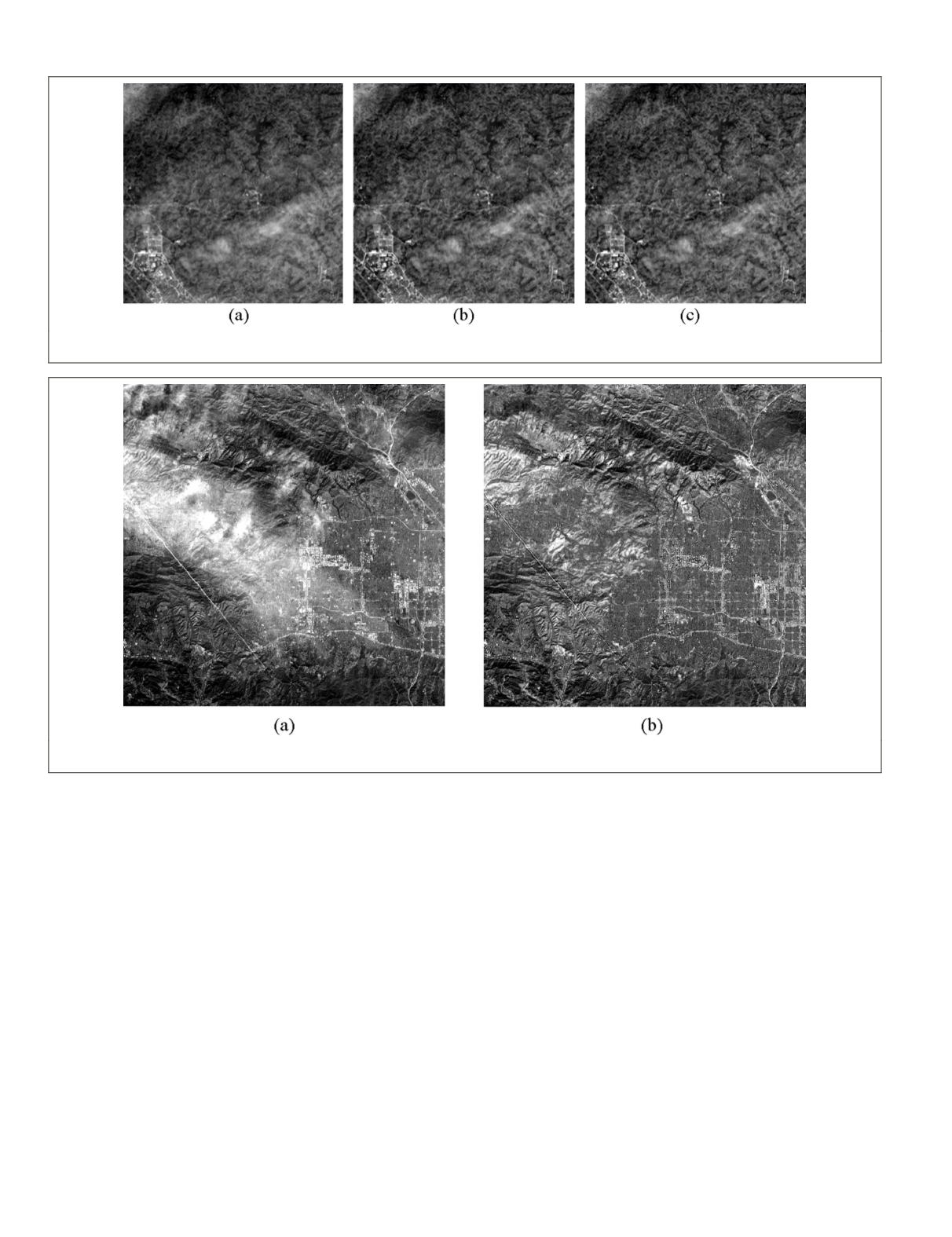
As a comparison, the homomorphism filter, IHS transform,
and wavelet transform approaches were applied to the re-
moval of clouds in the image acquired on 16 December 2013.
The presence of clouds was still visually noticeable after each
approach. Thus, the developed algorithm outperformed them
qualitatively. Spatial correlation coefficients of the “truth” im-
age and each cloud removed image were derived for Bands 1
through 5, respectively. Coefficients of cloudy regions ranged
from 0.42 to 0.88 for the homomorphism filter approach, from
0.54 to 0.75 for the IHS transform approach, and from 0.43 to
0.87 for the wavelet transform approach. Band-by-band, the
coefficients from the developed algorithm were higher than
those from the three approaches except for the coefficients
of Band 5 from the homomorphism filter and wavelet trans-
form approaches. Finally, the applicability of the algorithm
to another area of different land use and land cover types was
evaluated. The result in thin cloud removal was satisfactory.
Figure 10. Reflectance values of Band 3 of cloud-removed subimage acquired on 16 December 2013 using algorithms of the (a) homo-
morphism filter, (b) the IHS transform, and (c) the wavelet transform.
Figure 11. The Landsat-8 image acquired on 08 January 2014. The area was near northeast of Los Angeles, California. Reflectance val-
ues in Band 2 (a) before, and (b) after the algorithm applied.
730
September 2015
PHOTOGRAMMETRIC ENGINEERING & REMOTE SENSING


