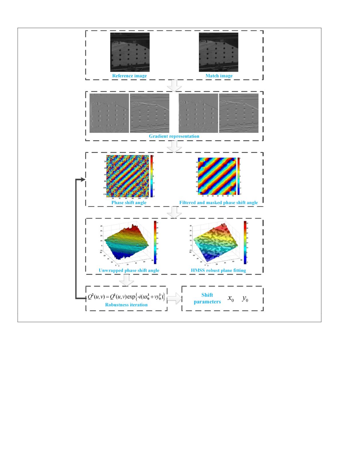
improved phase correlation method and other advanced image
processing algorithms to realize 3D vibration measurement.
The framework of the videogrammetric system is illustrated in
Figure 2, which consists of three main steps, i.e., system con-
struction and data acquisition, image sequence processing, and
data postprocessing and analysis. The image sequence process-
ing, which involves retrieving the 3D spatial coordinates of the
tracking points in the time domain, is the key point and main
contribution of our videogrammetric system. Details of these
three steps are briefly presented in the following.
System Construction and Data Acquisition
In order to reliably obtain the 3D spatial coordinates of the
target objects using photogrammetric theory, two prepara-
tory tasks should be carried out. On the one hand, camera
calibration needs to be performed to determine the interior
orientation parameters which define the geometric and optical
characteristics of the camera. The major parameters include
the principal distance, the principal point coordinates, and
the coefficients of the radial distortion, decentering distortion
and other systematic distortion (Luhmann
et al.
, 2016). On the
other hand, the control information needs to be input into the
photogrammetric model to provide the references of scale and
orientation. A control network is designed in advance, with
several control targets attached to some stationary objects. The
3D spatial coordinates of these control points can be surveyed
using an electronic total station before the observation. They
are then used to calculate the orientation parameters and
serve as checkpoints in the performance assessment.
In addition, two additional measures are generally consid-
ered before the data acquisition to enhance the flexibility and
feasibility of the videogrammetric technique, especially in
an indoor environment. The first issue is the light source. As
Figure 1. Workflow of the improved subpixel phase correlation method.
582
September 2018
PHOTOGRAMMETRIC ENGINEERING & REMOTE SENSING


