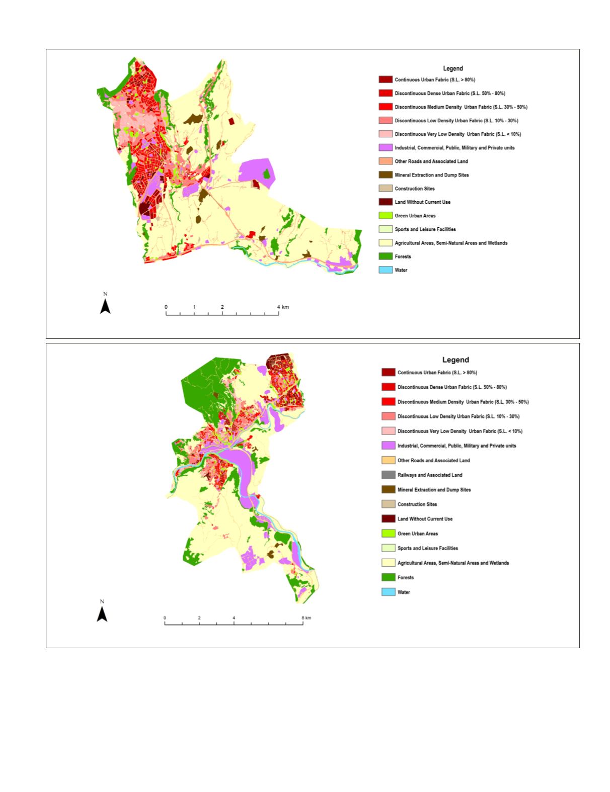
When all district-based values are examined, it is seen
that the percentage of all urban fabric classes in the Center
is greater than the percentage in the Safranbolu. The highest
percentage in all two districts belongs to low density and very
low density urban fabric. In both of the districts, forest areas
are the dominant classes, and secondly, the agricultural and
semi-natural areas.
Accuracy Assessment
Accuracy assessments performed for four regions based on
the classes used in the classification. Urban fabric classes par-
ticipated in the process of single class with the name of settle-
ment class. Randomly selected points on the classified im-
age’s actual classes have been determined from Google Earth
®
.
For Safranbolu and Center urban areas, 256 points were used
and overall accuracies respectively; 91.80% and 90.23% with
Figure 4.
LCLU
Map of Safranbolu urban area.
Figure 5.
LCLU
Map of Karabuk Center urban area.
PHOTOGRAMMETRIC ENGINEERING & REMOTE SENSING
November 2018
717


