obvious abnormalities was 4,646, which accounted for 0.90
percent of the entire sample. In particular, the largest positive
and negative errors were 1,195.22 m and −1223.99 m, respec-
tively, which were significantly higher and lower than the
SRTM
mission’s specifications. The mean error of the abnor-
mal areas was -35.52 m with an error standard deviation of
141.08. The mean error of the areas with elevation anomalies
exceeded that of the areas with vague topography by as much
as 14 fold. However, the number of points in the areas with
elevation anomalies was 1,450, which was less than 3,169,
the number of points in the areas with vague topography.
Figure 10 shows the distribution of these data abnormali-
ties, which are primarily located in the western part and
the northeast part of China. As seen from the background of
SRTM
hillshade data, areas with elevation abnormalities were
primarily distributed in the mountains, glacier-covered areas
and deserts. Because of the large elevation errors in these
regions and serious problems with topographic expression,
the impact of the abnormalities in the
SRTM
data on the ap-
plications and analysis should not be neglected. Although the
number of sample points in abnormal areas only accounted
for 0.90 percent of the entire sample, the number of sample
points with larger error (assuming an error of more than 50 m
as indicating large) located in the abnormal area accounted
for 68.59 percent of the entire sample of large errors. To avoid
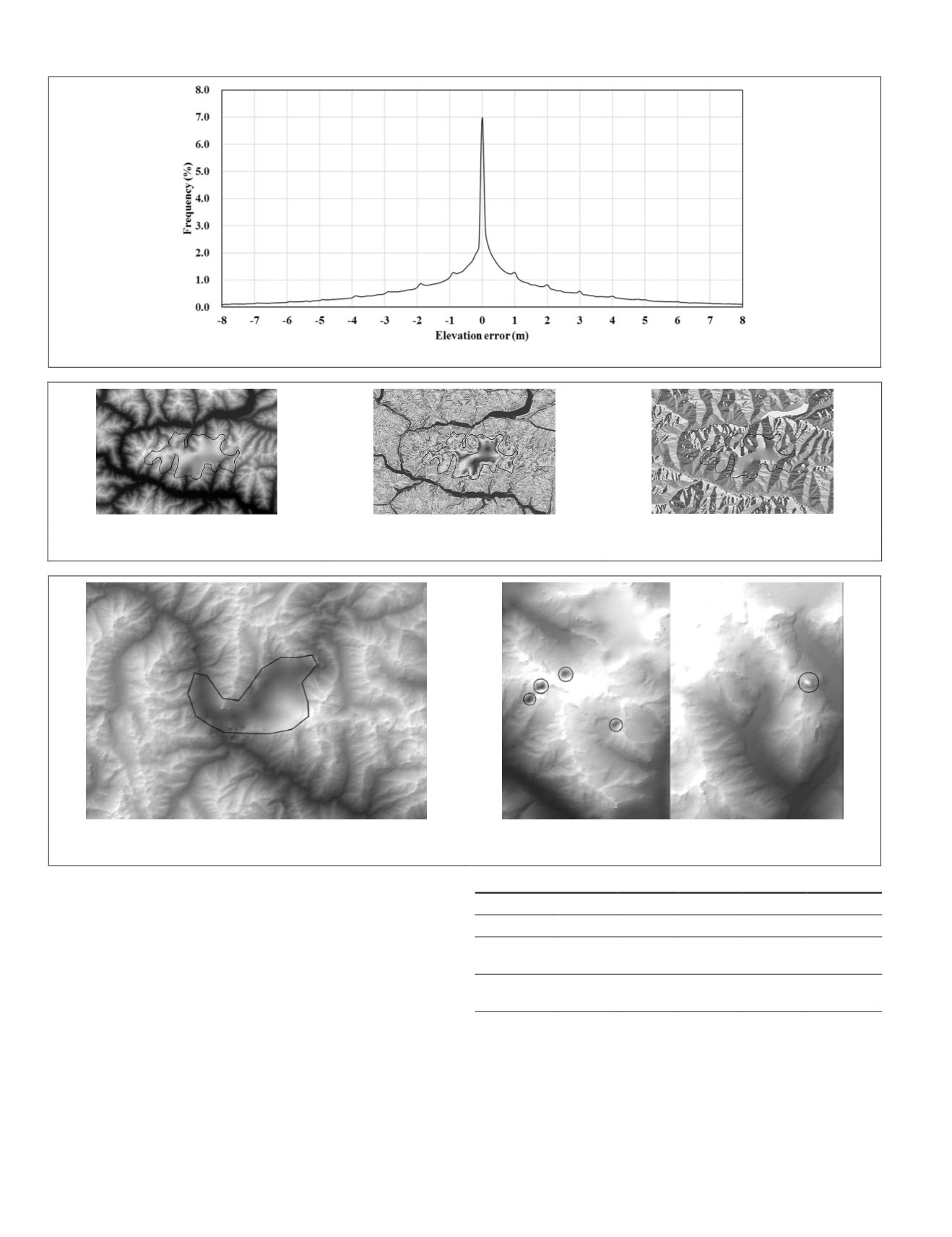
Figure 7. Frequency distribution of SRTM error (90 percent sample points).
(a)
(b)
(c)
Figure 8. Abnormalities expressed in the form of (a) elevation, (b) slope, and (c) aspect.
(a)
(b)
Figure 9. Obvious abnormality types: (a) “Vague topography” issue, and (b) “Elevation anomalies” issue.
T
able
1. S
tatistical
C
haracteristics
of
the
O
bvious
A
bnormalities
in
SRTM D
ata
Sample type Min(m) Max(m) Mean(m)
STD Size (m
2
)
All
-1223.99 1195.22 -35.52 141.08
4,646
Vague
topography
-1223.99 1195.22 -6.71 97.37
3,196
Elevation
anomaly
-769.84 231.36 -99.04 192.38
1,450
142
February 2016
PHOTOGRAMMETRIC ENGINEERING & REMOTE SENSING


