has a spectral range between 409.85 nm and 2494.57 nm and
a total of 366 spectral bands. The spectral resolution in the
visible and near infrared (
NIR
) wavelengths is 4.6 nm and the
resolution in the short-wave infrared (
SWIR
) wavelengths is
6.26 nm. The spatial resolution is 1.0 meter. Lidar data were
collected by
TRSI
in August 2008 as well, but Native Com-
munities Development Corporation Imaging (
NCDC
) led the
lidar data analysis and provided the final lidar data with the
coordinate system of
NAD27
State Plane Wisconsin South (
FIPS
4803) and mean point density of 4.5 points per m
2
. Besides
the remote sensing data, field data were collected in Septem-
ber 2015. Taking into account most of the trees in the study
area are the mature trees which grow very slowly, the gap
between August 2008 and November 2014 is acceptable. In
total, 198 lidar-detected trees along the roads in the study area
were identified, including 51 ashes, 59 maples, 70 oaks, and
18 other species. In addition, crown radius of each tree was
measured as a reference to the tree age. The radius was cal-
culated as the average radii measured in four perpendicular
directions from tree trunk to the edge. The radii of trees in our
research ranged from 1.73 m to 10.75 m, with mean of 6.04 m
and standard deviation of 1.62 m. Specifically, ash trees have
the largest crowns (mean = 6.86 m) with standard deviation of
1.40 m, maples and oaks have the average radii of 5.33 m and
6.15 m, with standard deviation of 1.19 m and 1.53 m, respec-
tively, and other species have the smallest crowns (mean =
4.40 m) with standard deviation of 1.53 m.
Data Preprocess
To remove the effects of the atmosphere on the images
spanning, the Quick Atmospheric Correction Model in
ENVI
(Research System, Inc., Boulder, CO) was first carried out for
atmospheric correction. And then the water absorption bands
(bands 181 to 200 and bands 253 to 280) corresponding to
the spectral regions of 1335.66 to 1454.68 nm and1786.7 to
1955.84 nm as well as the noisy bands (bands 361 to 366)
corresponding to the spectral region of 2463.25 to 2494.57 nm
were removed. Subsequently, a single image with 1.0 spatial
resolution was generated by mosaicing the images covering
the whole study area and co-registered to the gridded lidar
data (0.2 m) based on 60 ground control points and nearest
neighbor resampling. The control points were selected from
corners of building and intersections of roads, and the root
mean square error (
RMSE
) was 0.2 pixels, the very small value
indicated that the images were well matched.
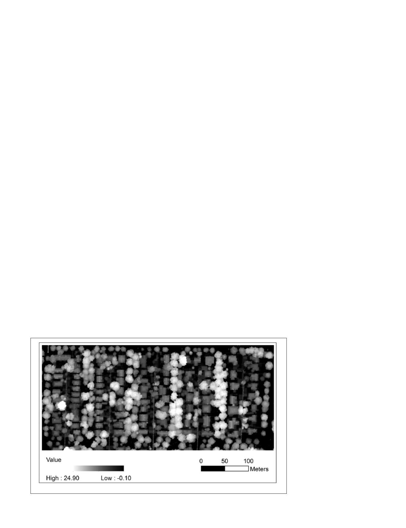
Due to lidar’s characteristics of penetrating through forest
canopy(Popescu and Wynne, 2004), randomly distributed
exceptionally lower height values in a raster, named data pits,
are typically found in the
CHMs
derived from the raw lidar
data (see Figure 1). These pits may adversely affect the crown
segmentation, tree height estimation, and forest biomass
calculation (Ben-Arie
et al
., 2009). Therefore, the extraction
of lidar points on the crown surface rather than within the
crown is prerequisite to create a smooth crown surface. In
this research, we applied the treetop height difference (
THD
)
method (Liu and Dong, 2014) to select the highest 30 percent
points of search windows with a radius of 1 m and interpo-
lated them into
CHM
(see Figure 2).
Methodology
To automatically and accurately classify tree species at the
crown level, four main steps were carried out, and they in-
clude: (1) individual tree identification based on the smooth
CHM
, (2) shape feature extraction from individual tree crowns,
(3) crown-scale spectra calculation from hyperspectal imag-
ery, and (4) data fusion for tree species classification. These
steps are presented as follows.
Individual Tree Identification
Individual trees were identified on the smooth
CHM
with two
major steps. The locations of tree tops were first detected with
a local maximum (
LM
) filtering method (Popescu and Wynne,
2004). The
LM
technique operates on the assumption that
the highest point in the spatial neighborhood represents the
treetop of a tree crown, and the window size to search for the
tree top is dependent on the strong relationship between the
tree height and the crown size (Popescu, 2007; Popescu and
Wynne, 2004). Specifically, a circular shaped window moves
through the
CHM
to search for the treetop. That is, if a given
pixel is the highest among all other pixels within a search
window, it is identified as a treetop, wherein the window
radius was automatically calculated using a linear regression
model developed by Liu and Wu (2016). For this research, in
order to analyze the classification accuracy, only the public
trees along the roads were manually selected. Further, control
points on each crown boundary were extracted as the low-
est points between a treetop and its adjacent treetops. In
response to the circular crown shapes observed from above,
circles were automatically drawn on the
CHM
. The centers of
circles were located at treetop location and the circle radii
were calculated as the average
distance between the treetop and
its control points.
Spectral Feature Extraction from AISA
Hyperspectral Imagery
Crown-scale spectra were direct-
ly extracted from the pixel at the
treetop location (Zhang and Qiu,
2012). The treetop pixel, located
in the center of a tree crown,
is less likely to experience the
pixel mixture problems caused
by gap, shadow, and other spe-
cies, which usually occur around
crown boundaries. In addition,
treetop, as the highest point, is
rarely impacted by double-sided
illumination problems, which
are common on the two sides
of crown scales (e.g., sun-side,
shaded-side). Therefore, treetop
pixel is the best portion of a tree
crown to represent the spectral
signature of an individual tree
Figure 2. Smooth canopy height model.
PHOTOGRAMMETRIC ENGINEERING & REMOTE SENSING
August 2018
497


