exhibited a certain range of error offsets as shown in Figure
9a, 9b, 9e, and 9f. This implies an effect of a consistent verti-
cal offsets of the
ASTER DEM
, which accounts up to 15 to 20 m
according to an inter-comparison with the lidar
DEM
. Especial-
ly combined with large atmospheric delays shown in part 2
cases,
DEM
errors quite misled the deformation measurements.
DInSAR
processing results with
SRTM
-based
DEMs
and atmo-
spheric correction produced quite reasonable outputs in both
Figure 9g which represented a relatively small atmospheric
phase delay and 9h which is corresponding to large atmo-
spheric errors (see the large deviation in 9d) which represent-
ed the errors without atmospheric correction). However, there
are still considerable error residuals when compared with the
estimated error line. Those induced a number of false defor-
mations shown in Figure 6b and 6e.
The results demonstrated why the high-accuracy two-pass
DinSAR analyses corrected with not only precise
APS
but also
with relatively error-free
DEMs
with fine resolution, can be
considered to be essential for landslide forecasting. Also it im-
plies that the accuracy of
DInSAR
analysis with lidar-based
DEM
and atmospheric correction is high enough to produce reason-
able deformation patterns as shown in Figure 6c and 6f).
Evaluation and Landslide Risk Assessment
In this study we have shown problems and presented solu-
tions in the utilization of surface deformation by multi-pass
DInSAR
as an indicator for locations of potential landslides oc-
currences. The effects of error components from tropospheric
turbulences and base topography in particular are significant
when
DInSAR
is employed to detect the surface deformations.
These effects were further elucidated over the localized high-
relief topography, where orographic effects and local atmo-
spheric instability frequently occur. In particular, when using
DInSAR
employing low-resolution
DEM
and no atmospheric
correction will create inaccurate location forecasts for poten-
tial landslides.
Although it is not clear that time series analyses that
were developed to deal with such issues are effective in the
case where numbers of
InSAR
pairs are not sufficient,
StaMPS
processing results showed some similar deformation pat-
terns with the outputs from corrected
DInSAR
, as observed in
Figures 3 and 5, especially over steep roadside cuts near the
seashore.
LOS
displacement values which are dependent on the rela-
tionships between sensor geometry and the local topography,
were projected along to the slope orientation in order to obtain
real direction of surface creep and remove upward directional
false creep using the relationship (Bianchini
et al
. 2013)
Disp
Disp
cos
slope
LOS
=
θ
(14)
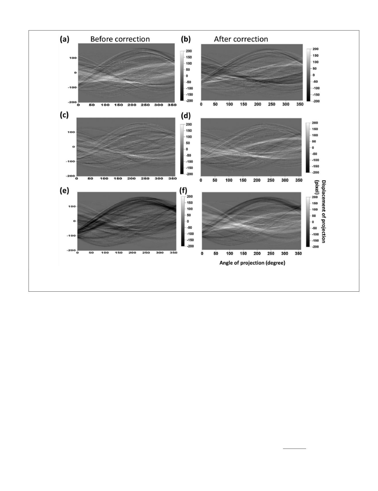
Figure 8. Random transformations of phase angles of pair 1 (15 January 2005 to 30 April 2005) using (a) and (b);
ASTER DEM
without/with atmospheric correction, (c) and (d)
SRTM DEM
without/with atmospheric correction; and (e) and f) lidar
DEM
without/with atmospheric correction.
PHOTOGRAMMETRIC ENGINEERING & REMOTE SENSING
April 2018
197


