crops (corn (94%), barley (90%), other cereals (95%), rape-
seed (96%),
…
). However, forage crops and fruit trees were
not identified by the classifier and were instead classified as
meadows (cf. Table 8). Forage crops class is harder to classify
using only satellite observations since it is more a land use
class than a land cover class, based on agricultural knowledge
about the destination of cereal crops. Table 8 shows that the
meadows class is often confused with other classes, particu-
larly fruit trees and other cereals. Meadows are composed of
trees and bare soils and have a low volumetric radar response
that make them indistinguishable from other cereals.
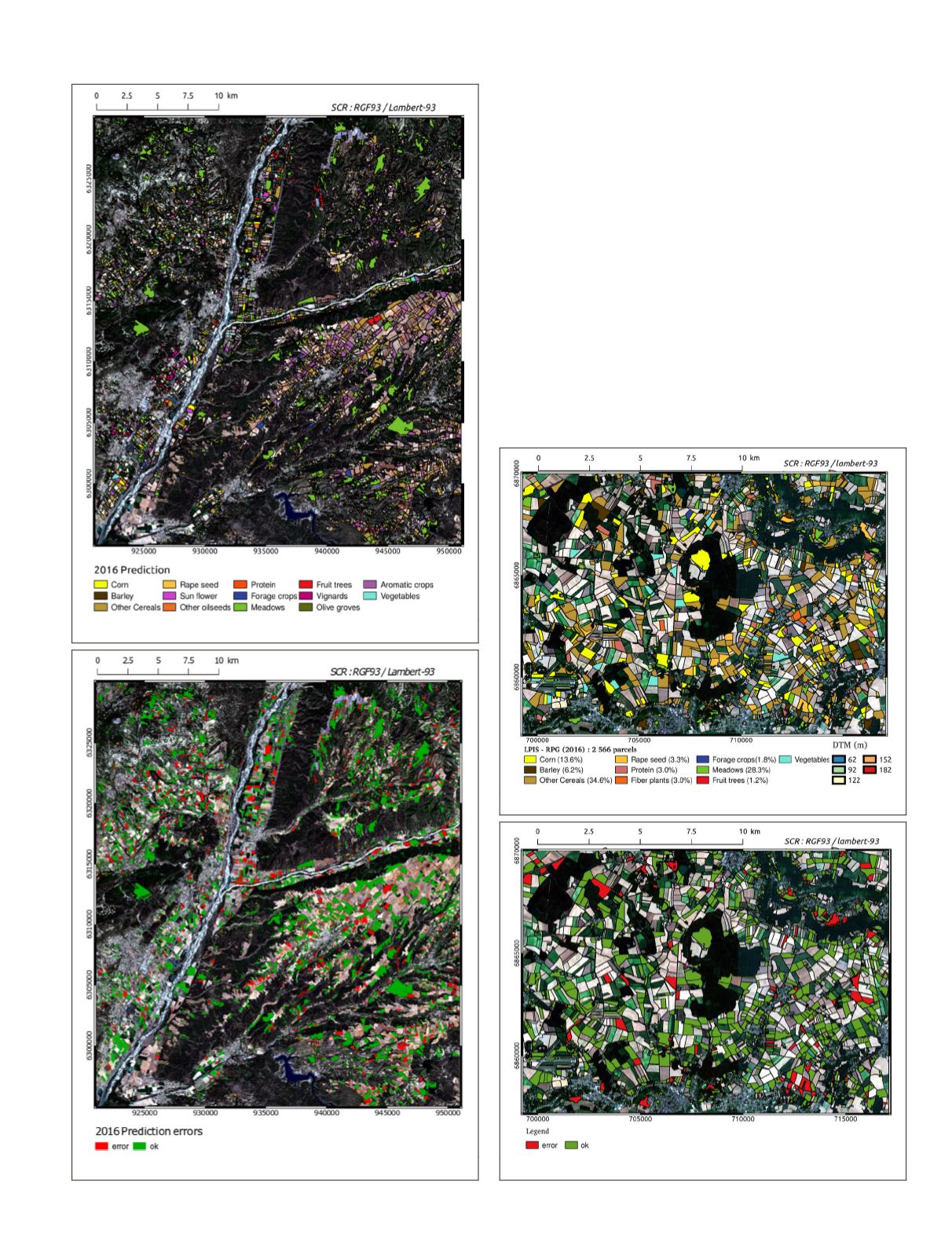
The quality of the prediction is lower for Site04 , with a
weighted F-scores varying between 61% and 71%. This is due
to the presence of more classes (14), small size of parcels, and
highly imbalanced classes where meadows and other cereals
represented almost 50% of the area, as shown in Figure 3.
Similar to Site77, the confusion matrix for combined optical
and radar data (Table 7) shows that most ambiguities occurred
on meadows classes, other cereals, and forage crops. Besides,
aromatic crops represented 12.3% of the area and proved
hard to classify correctly.
Figure 10. Site04: Crop type predictions.
Figure 11. Site04: Prediction errors.
Figure 12. Site77: Crop type predictions.
Figure 13. Site77: Prediction errors.
PHOTOGRAMMETRIC ENGINEERING & REMOTE SENSING
July 2020
437


