changes reveal the high standard deviation of the
DSM
. Regard-
ing the area of inclined topography, the difference between the
TLS
height values and those generated by each camera (
M/SD
)
were −0.033 m/0.074 m for the S7 with
RS
off, −0.037 m/0.041
m for the S7 with
RS
on, and −0.031 m/0.038 m for the
NX
. The
inclined topography revealed a high standard deviation of
DSM
compared to the flat topography. There were big differences
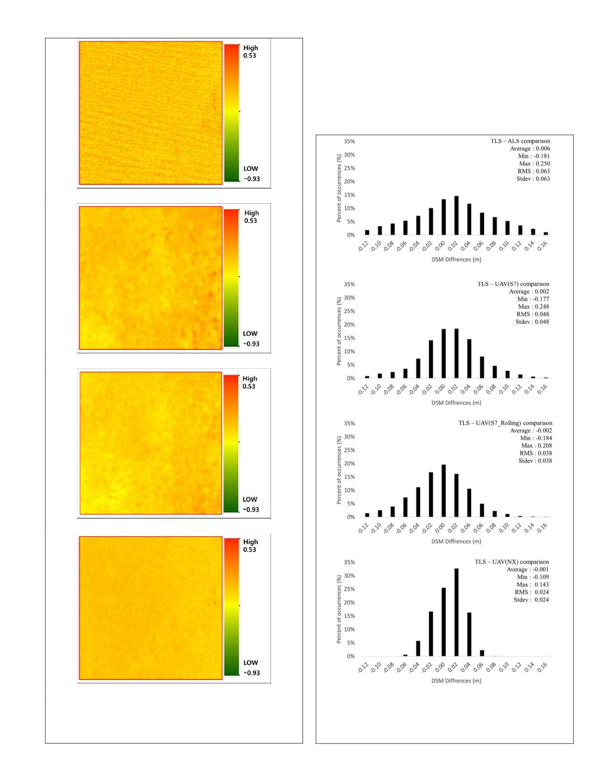
(a) ALS
(b) S7 rolling shutter option off
(c) S7 Rolling Shutter option on
(d) NX
Figure 8. Difference between terrestrial laser scanning
height and (a) airborne laser scanning, (b) S7 (rolling-shutter
option off), (c) S7 (rolling-shutter option on), and (d)
NX
on
flat area (green zone in Figure 1).
(a) ALS
(b) S7
(c) S7 (Rolling Shutter)
(d) NX
Figure 9. Absolute vertical differences between the
terrestrial laser scanning digital surface model and digital
surface models on flat area derived from (a) airborne laser
scanning, (b)
S7
, (c)
S7
(rolling shutter), and (d)
NX
.
PHOTOGRAMMETRIC ENGINEERING & REMOTE SENSING
December 2019
895


